
Tracker map update 11.11.21 https://www.google.com/maps/d/viewer?mi ... 467837&z=9
Tracker map is provided by Ornitela: https://www.ornitela.com
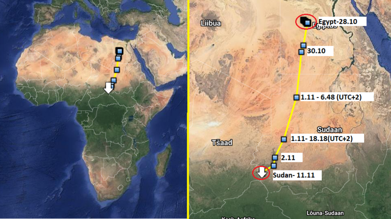
Previous data: 28.10.21. Farafra, Egypt
New data: 11.11.21. Wadi Salih province, Central Darfur region in south-western Sudan. Near the border of Tchad
Wadi Salih Province: https://en.wikipedia.org/wiki/Wadi_Salih
Total distance flown from Egypt tp Sudan - 1977 km.
3D of 28.10-11.11 by Lukaš: https://ayvri.com/scene/ykxwgxee59/ckvv ... 6k1cblbn2e
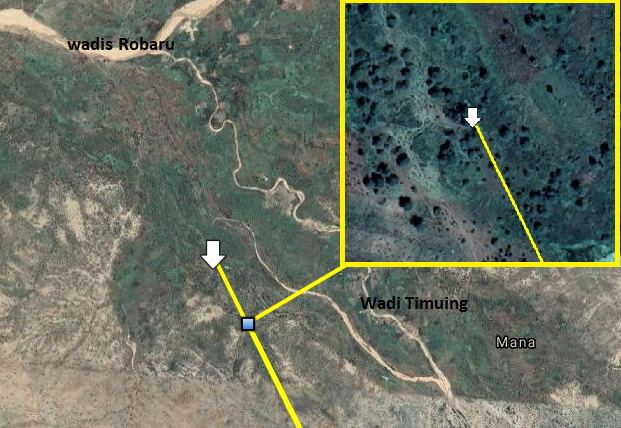
Udu is staying on vegetated areas. Nearby are Wadi Robaru and Wadi Timuing.
wadi- Arabic term traditionally referring to a valley. In some instances, it may refer to a dry (ephemeral) riverbed that contains water only when heavy rain occurs. (https://en.wikipedia.org/wiki/Wadi)
View of a wadi in Nyala- the capital city of the Central Darfur Region - illustration (click) https://i.postimg.cc/y8N8h7Fg/Nyala-Darfur.jpg (source: https://www.newsecuritybeat.org/2015/08 ... -conflict/)
