Its diverse habitats include bogs, marsh meadows, sand dunes and sandy forests. The most typical tree species are the english oak ( (Quercus robur) and the white poplar (Populus alba).
Previous
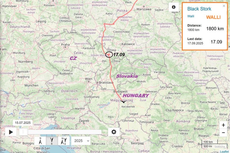
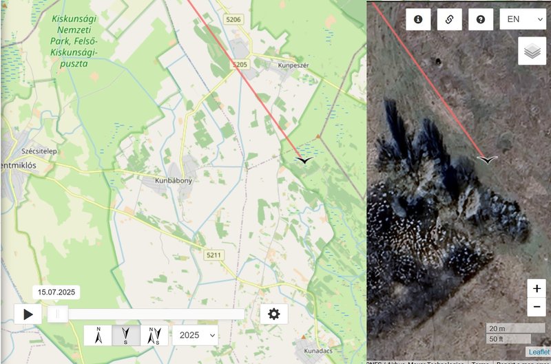
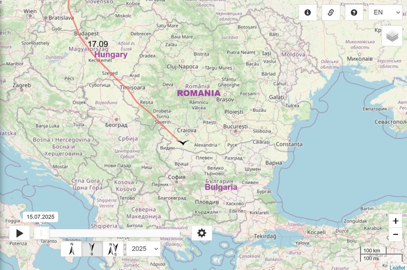
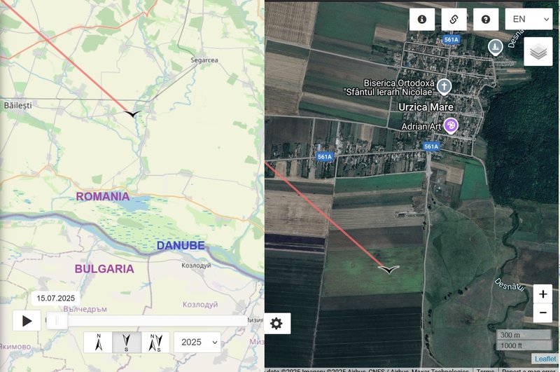
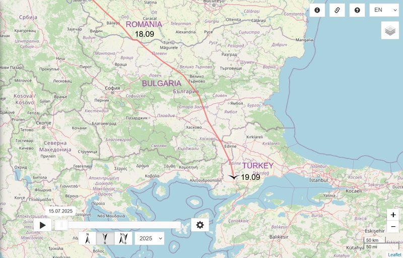
- 18.09, Distance: 2276 km (+ 476 km !)
- ROMANIA: Urzica Mare - a village in Dolj County
NEW
travelling day
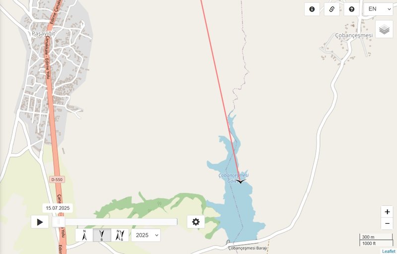
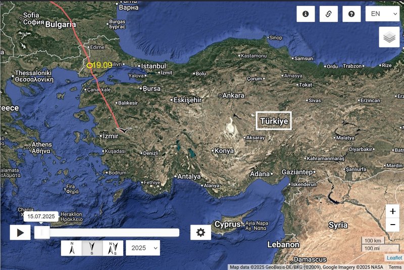
- 19.09, Distance: 2716 km (+ 440 km !)
- TURKEY/Europe: Çoban Çeşmesi Baraji/Muzalı Göleti (pond/reservoire) / Çobançeşmesi - a village in the Keşan District of Edirne Province
Previous travelling day
- 19.09, Distance: 2716 km (+ 440 km !)
- TURKEY/Europe: Çoban Çeşmesi Baraji/Muzalı Göleti (pond/reservoire) / Çobançeşmesi - a village in the Keşan District of Edirne Province
NEW travelling day
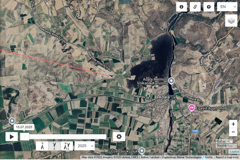
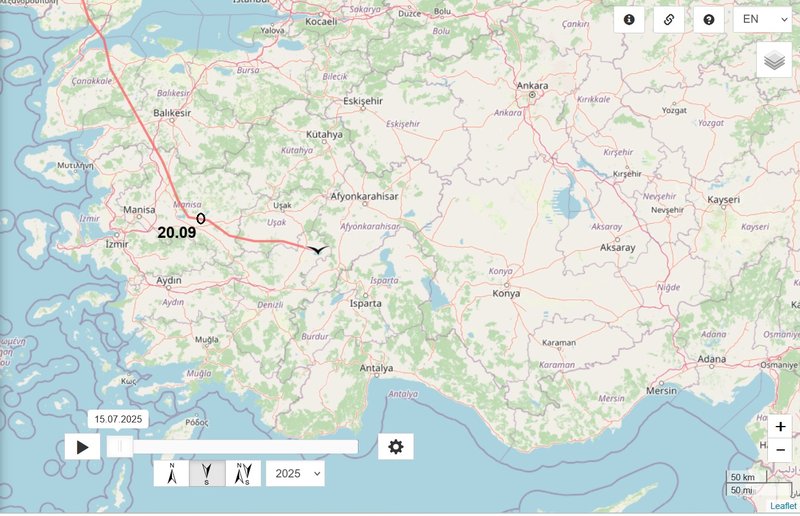
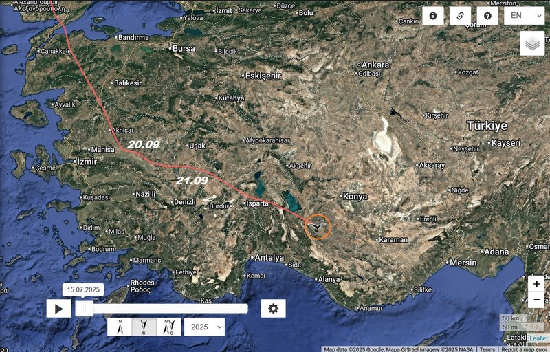
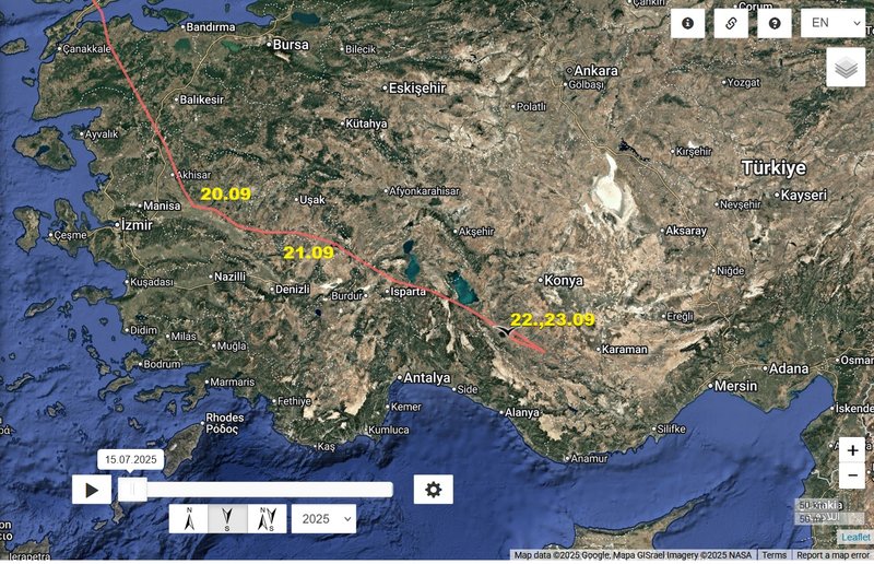
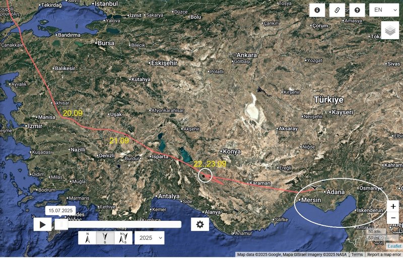
- 20.09, Distance: 3020 km (+ 304 km)
- TURKEY/Asia: Adala - a village in Salihli İlçesi a municipality and district of Manisa Province
Previous data travelling day
- 20.09, Distance: 3020 km (+ 304 km)
- TURKEY/Asia: Adala - a village in Salihli İlçesi a municipality and district of Manisa Province
NEW data travelling day
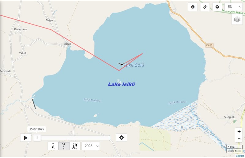
- 21.09, Distance: 3176 km (+ 156 km)
- Turkey: Işıklı Lake - a freshwater lake in Turkey's inner Aegean Region extending on Çivril Plain between the provinces of Denizli and Afyonkarahisar
(the lake is IBA / Important Bird Area https://datazone.birdlife.org/site/fact ... Monitoring)
the situation is very bad (drought) Işıklı Lake, famous for its water lilies and boat tours, has dried up. The danger bells are ringing. The lake is waiting to be saved
uploaded on 22.08.2025 by Genç Çivril Gazetesi
https://www.egirdirakingazetesi.com.tr/ ... aylasiyor-:
... We had a tele-conference with Prof. Dr. İskender GÜLLE. A question arose in our minds: "Are IŞIKLI Lake and Lake EĞİRDİR sharing the same fate?" IŞIKLI was the name of the village where the lake's water flowed from. The lake also had another name: ÇİVRİL Lake, which was also the name of the district, just like Lake EĞİRDİR and EĞİRDİR district.
Decreasing rainfall, increasing water extraction, and the drying up of the streams that feed the lake were the main causes behind the loss of 90% of the lake's water volume. Concerns about the sustainability of the lake, and the possibility that it may not return to its former state, were growing. Just like in Eğirdir, where intensive fruit farming (primarily apples) is practiced, ÇİVRİL also had the same situation. Apple, peach, and apricot farming were the primary crops. When combined with excessive water extraction from the lake and the negative impacts of increasing drought, our lakes are heading toward an inevitable outcome!
The tragic situation our lakes have fallen into is not only a critical issue for wetlands but also a major challenge for our future, both from socio-economic and socio-cultural perspectives! Recognizing this danger, ÇİVRİL Municipality invited our scientists to discuss the matter and search for solutions.
Previous data travelling day
- 21.09, Distance: 3176 km (+ 156 km)
- Turkey: Işıklı Lake - a freshwater lake in Turkey's inner Aegean Region extending on Çivril Plain between the provinces of Denizli and Afyonkarahisar
NEW data travelling day
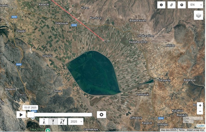
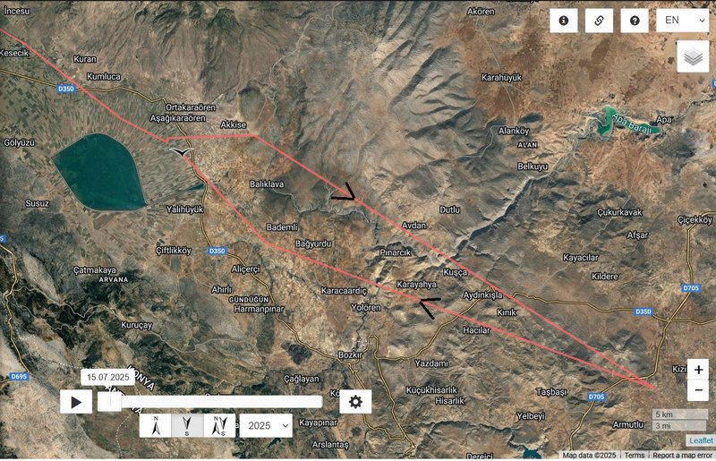
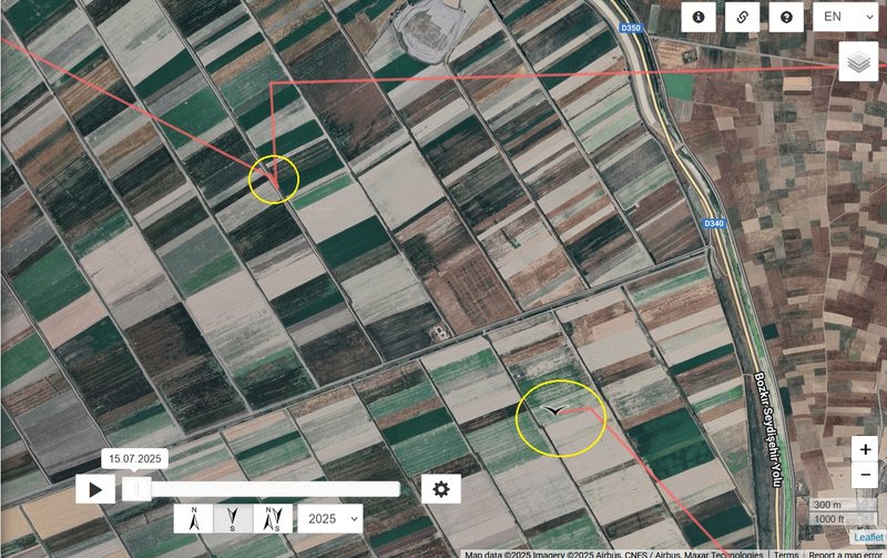
- 22.09, Distance: 3392 km (+ 216 km)
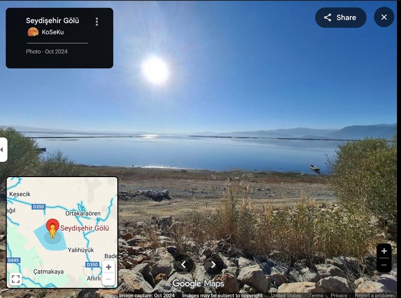
- Turkey: Lake Suğla or Yalıhüyük/Seydişehir Gölü (=Lake) - is located in the southwestern part of Konya province
continuation:
VIDEO uploaded on 13.03.2025 by Doğadaki Keşiflerim
26.08.2024
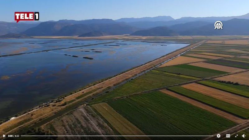
Suğla Lake in Konya is affected by drought!
Suğla Lake, located in the Seydişehir district of Konya, nourishes the surrounding agricultural lands while also hosting species that allow for fishing. Recent drought and high temperatures have led to the receding waters in the lake, leaving cattle grazing in the newly created areas.
VIDEO: https://www.facebook.com/tele1comtr/vid ... 532432486/
pic form this video:
Previous data travelling day
- 22.09, Distance: 3392 km (+ 216 km)
- Turkey: Lake Suğla or Yalıhüyük/Seydişehir Gölü (=Lake) - is located in the southwestern part of Konya province
NEW data travelling day
- 23.09, Distance: 3491 km (+ 99 km)
- Turkey: Lake Suğla or Yalıhüyük/Seydişehir Gölü (=Lake) - is located in the southwestern part of Konya province
Previous data travelling day
- 23.09, Distance: 3491 km (+ 99 km)
- Turkey: Lake Suğla or Yalıhüyük/Seydişehir Gölü (=Lake) - is located in the southwestern part of Konya province
NEW data travelling day
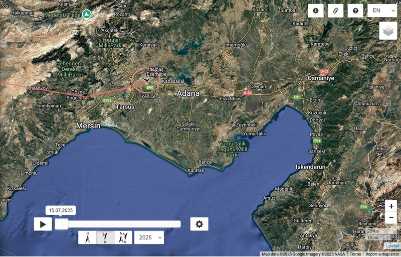
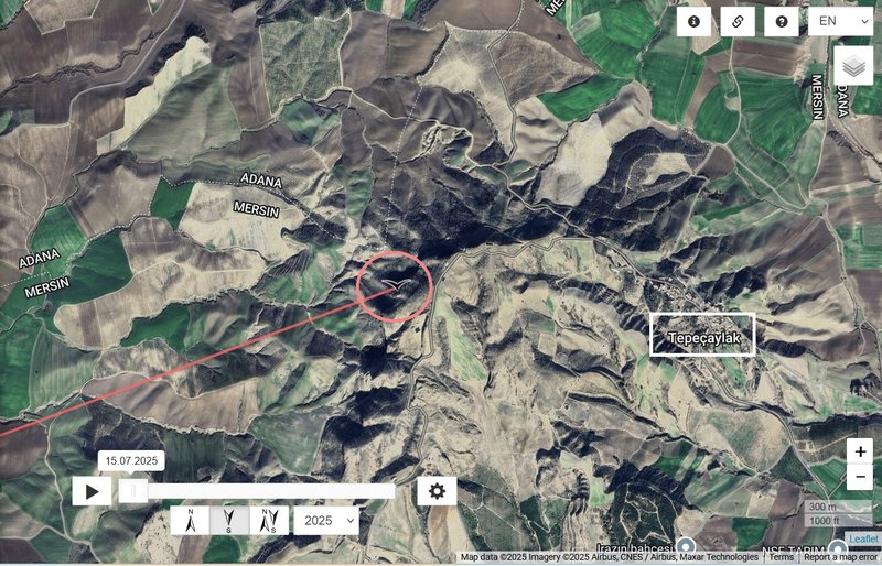
- 24.09, Distance: 3767 km (+ 276 km)
- Turkey: Tepeçaylak - a neighbourhood in the municipality and district of Tarsus, Mersin Province
Walli continued to the Gulf of İskenderun (or Gulf of Alexandretta)
Previous data travelling day
- 24.09, Distance: 3767 km (+ 276 km)
- Turkey: Tepeçaylak - a neighbourhood in the municipality and district of Tarsus, Mersin Province
NEW data travelling day
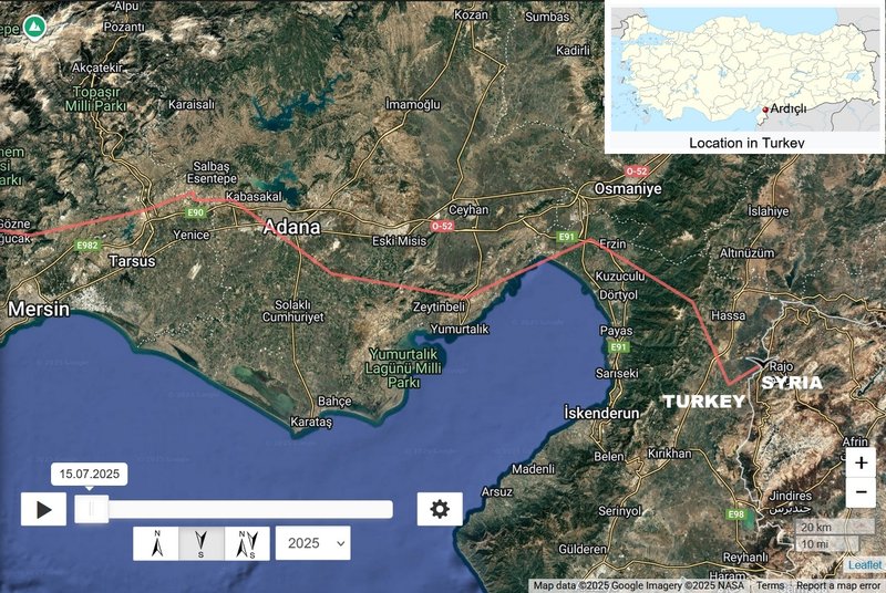
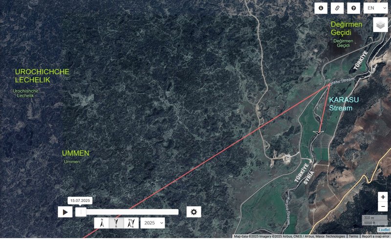
- 25.09, Distance: 3938 km (+ 171 km)
- Turkey/SYRIA: Ardıçlı - is a neighbourhood of the municipality and district of Hassa Hatay Province
south of Değirmen Geçidi, along the Karasu or Aswad stream - a river in the provinces of Gaziantep and Hatay in Turkey. For part of its length it forms the border with Aleppo Governorate in Syria (it joins the Afrin River at the site of the former Lake Amik; its waters now flow to the Orontes by a canal)
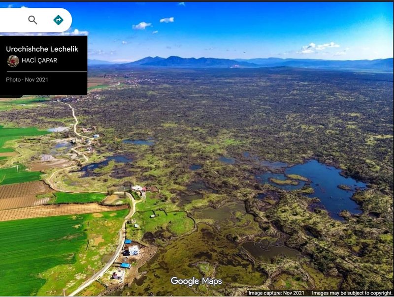
Chat GPT says: The Lechelik Area in Hatay is an intriguing natural gem with its volcanic origins, wetland ecosystems, and rich biodiversity. While it may not be as well-known as other tourist hotspots in Turkey, it represents an important natural heritage that could play a role in both conservation and local development.
VIDEO/REEL
Lechelik Area
These ponds, formed among lava flows thousands of years ago, are located in the Hassa district of Hatay. This place, known as "Lechelik," hosts many different species of wildlife, making it a unique natural area.