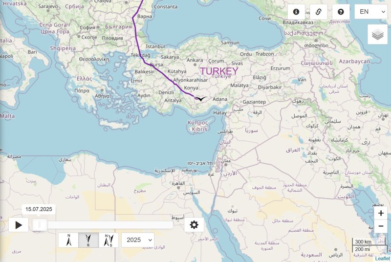
Previous data
- 06.09.2025, Distance: 3741 km
- Turkey: Paşalimanı Adası / P. Island - an island in the southern Sea of Marmara; administratively belongs to the Erdek town of Balikesir Province (northwestern Turkey)
NEW data
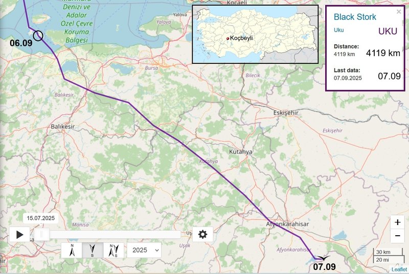
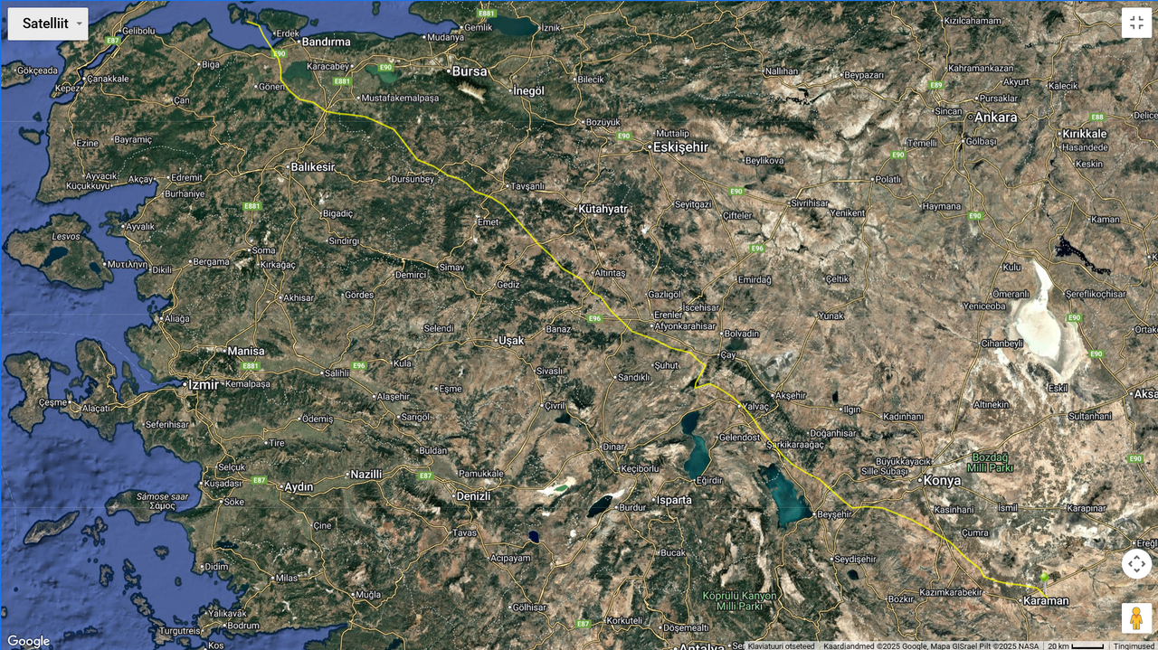
- 07.09, Distance: 4119 km (+ 378 km)
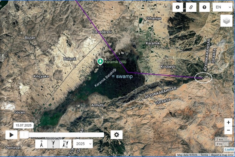
- TURKEY: to the east from the Karamik Gölü (after fire) - on the border of Çay and Sultandag districts of Afyonkarahisar Province
(stork crossed the Sea of Marmara)
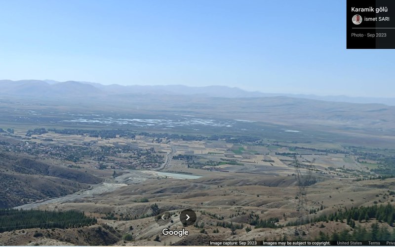
Karamık Swamp or Karamık Lake (Turkish: Karamık Bataklığı or Karamık Gölü) https://en.wikipedia.org/wiki/Lake_Karam%C4%B1k
It is a very shallow lake and in some sources it is called a "marsh" - the deepest point of the lake is 3 m. The total area of the marsh area is about 40 square kilometres. The lake was declared as 1st Degree Natural Conservation Site.
very short video (0:12)
Karamık Gölü (Bataklığı)
20.08.2025
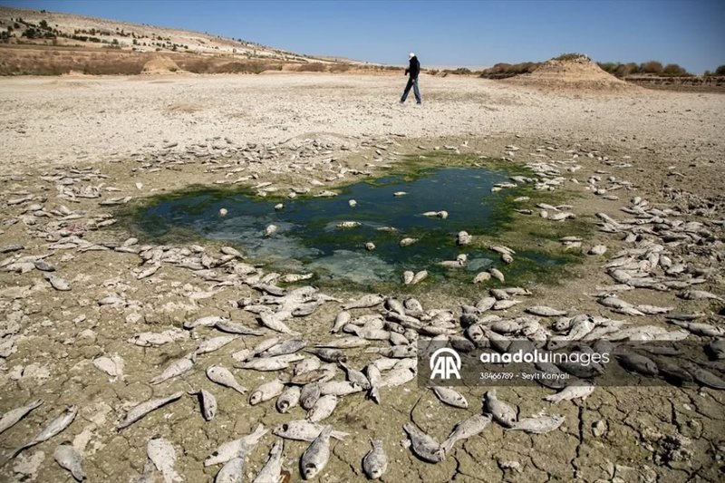
... According to the images received to the Afyon Posta WhatsApp Notification Line, the fire that started in the morning around Karamık Lake, which is located on the border of Çay and Sultandag districts of Afyonkarahisar, threatens the lake ecosystem. Locals have called for urgent measures from authorities, saying heavy smoke has covered the village.
(source: https://www.afyonpostasi.com.tr/karamik ... le-cagrisi - PHOTO)
ChatGPT: CURRENT SITUATION AND CONSEQUENCES of THE FIRES
(An up-to-date overview of the situation at the Karamık wetlands/lake (Karamık Gölü) in Turkey and the consequences of the fires from August 2025)
Fire and Its Control
On August 21, 2025, a fire broke out in the reed beds near Karamık Gölü (in the Çay district, Afyonkarahisar province). The fire spread quickly due to the wind and the nature of the wetlands, which made it difficult for fire trucks to access the area.
According to local authorities, the fire was likely caused by smoke coming from underground structures that could reignite when exposed to wind. However, firefighters managed to control the fire.
Local residents confirmed that there was not just one fire but repeated fires—several days apart, another part of the reed beds caught fire, and smoke was visible even without active flames.
Ecological and Water Management Consequences
The village head (muhtar) of Koçbeyli pointed out that Karamık Gölü has long suffered from water shortage. The wetlands and lake are drying up due to drought and illegal water pumping for irrigation. This has led to the death of aquatic life, loss of vegetation (which also helped retain moisture), and the current state where the water body is unusable.
The village head believes that if illegal water pumping through drilled wells is stopped, the water could return and restore the lake within one year.
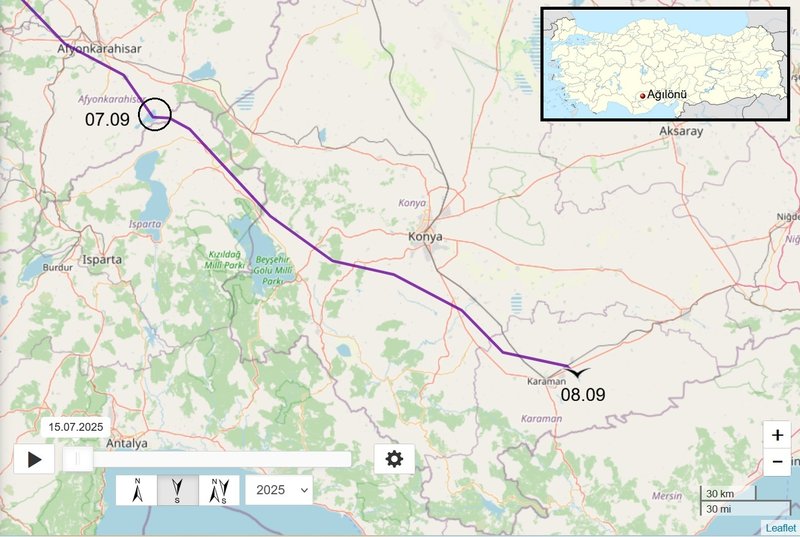
Previous data
- 07.09, Distance: 4119 km (+ 378 km)
- Turkey: to the east from the Karamik Gölü (after fire) - on the border of Çay and Sultandag districts of Afyonkarahisar Province
(stork crossed the Sea of Marmara)
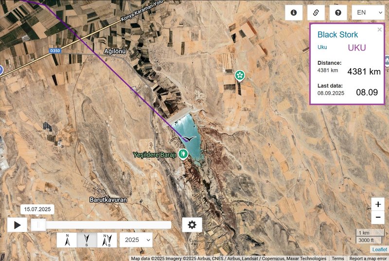
NEW data
- 08.09, Distance: 4381 km (+ 262 km)
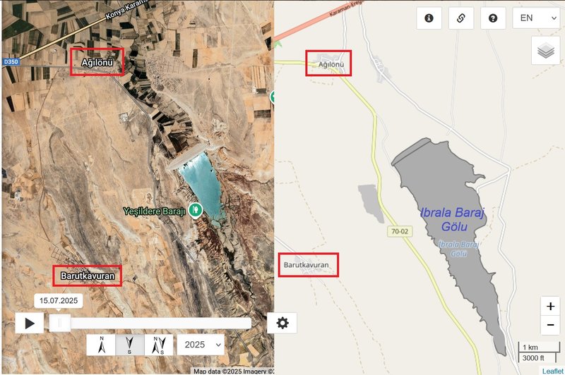
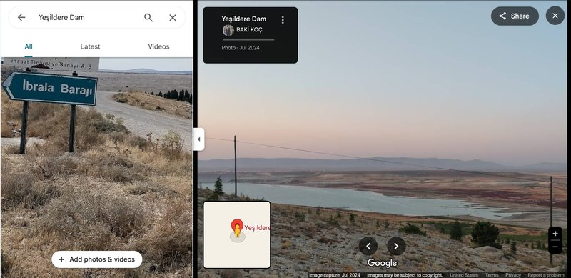
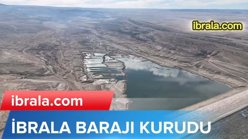
- Turkey: İbrala Baraj Gölü / İbrala Dam - a dam built on the İbrala Stream in Karaman
(between 1998 and 2004 for irrigation purposes)
stork continued above the Anatolian plateau to one dam/reservoir
FB Seyit Konyalı - 05.07.2025 - at İbrala Baraj Gölü "Drought-related fish deaths were observed at the İbrala Dam in Karaman." https://www.facebook.com/184S604/posts/ ... cale=et_EE - more PHOTOS + posts/reporting about the other dry/drying big lakes in Turkey
VIDEO (0:40) https://youtu.be/dJ3g0CyEhUQ?si=zsnQkDlMoHDDHxzY uploaded 30.06.2025 "The water level at the Ibrala Dam fell dangerously, while Karaman Provincial Directorate of Agriculture and Forestry teams mobilised to rescue the dehydrated fish."
Site Description:
Yeşildere Important Nature Area is a valley located approximately 15 kilometers east of the city center of Karaman. It begins in the eastern part and forms narrow gorges and meanders. The Yeşildere stream, which forms the valley, originates from the northern foothills of the Taurus Mountains. The İbrala Dam is currently under construction at the point where the stream intersects with the Karaman-Aksaray road.
Habitats:
The Important Nature Area (INA) consists of riverside vegetation communities, poplar groves, and agricultural lands. Along Yeşildere, there are reed beds in certain parts. The valley is surrounded by moderately elevated hilly areas.
Species:
The freshwater fish species Gobio hettitorum, which is found only in this INA and nowhere else in the world, lives in Yeşildere.
Land Use:
Both dry and irrigated farming are practiced in the region. Animal husbandry is also an important source of livelihood. The valley formed by Yeşildere serves as a recreational area for the local people.
Threats:
The most significant threat to the INA is the construction of the İbrala Dam on Yeşildere. The dam aims to irrigate 8,700 hectares of land and supply drinking water. Once the construction is completed, the endemic freshwater fish species in the stream may face extinction.
Conservation Efforts:
There are no known specific conservation efforts in the area.
- GPS interference in geopolitical conflict zones (Published 22 July 2025) https://gard.no/insights/gps-interferen ... ict-zones/
- GPS Jamming, Spoofing and Hacking (Published: 19 June 2025) https://north-standard.com/insights-and ... nd-hacking
- GNSS spoofing in conflict zones disrupts wildlife tracking and hampers research and conservation efforts (Published: 30 January 2025) https://pmc.ncbi.nlm.nih.gov/articles/PMC11782602/ In war and conflict zones, the jamming of Global Navigation Satellite System (GNNS) signals by military forces disrupts the tracking of tagged animals, and has increased in frequency following the recent escalation of conflicts in Eastern Europe and the Middle East.
Previous data
- 08.09, Distance: 4381 km (+ 262 km)
- Turkey: İbrala Baraj Gölü / İbrala Dam - a dam built on the İbrala Stream in Karaman
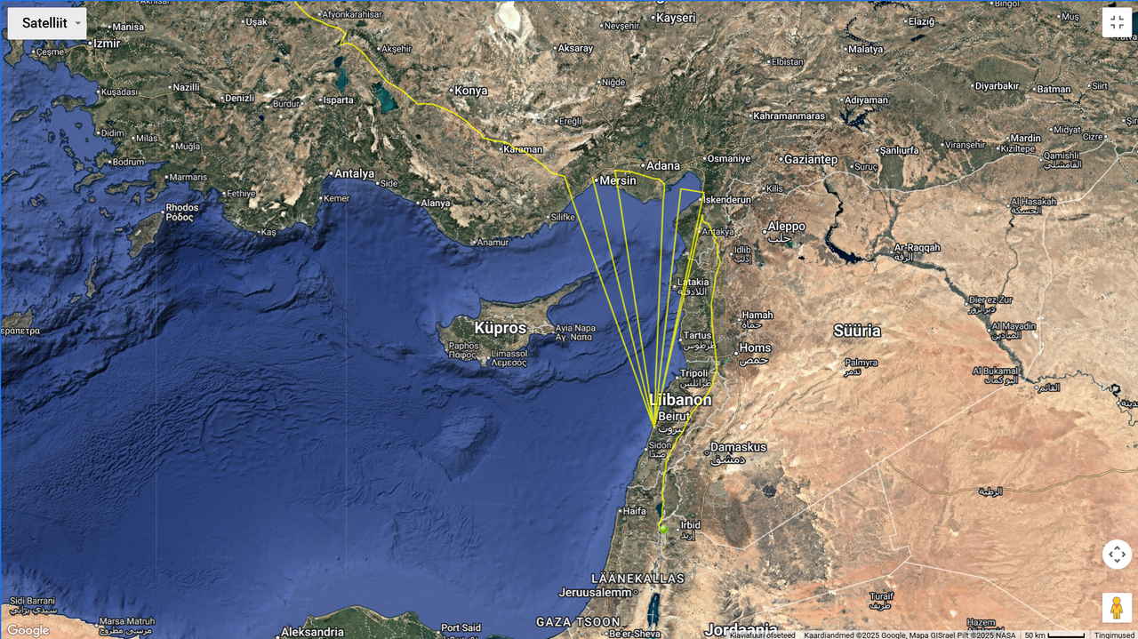
- 09.09
- SYRIA: between Kafar Thakarim and Talamar - a village in northern Syria, administratively part of the Idlib Governorate, located northwest of Idlib and just east the Syrian–Turkish border (wiki)
NEW data
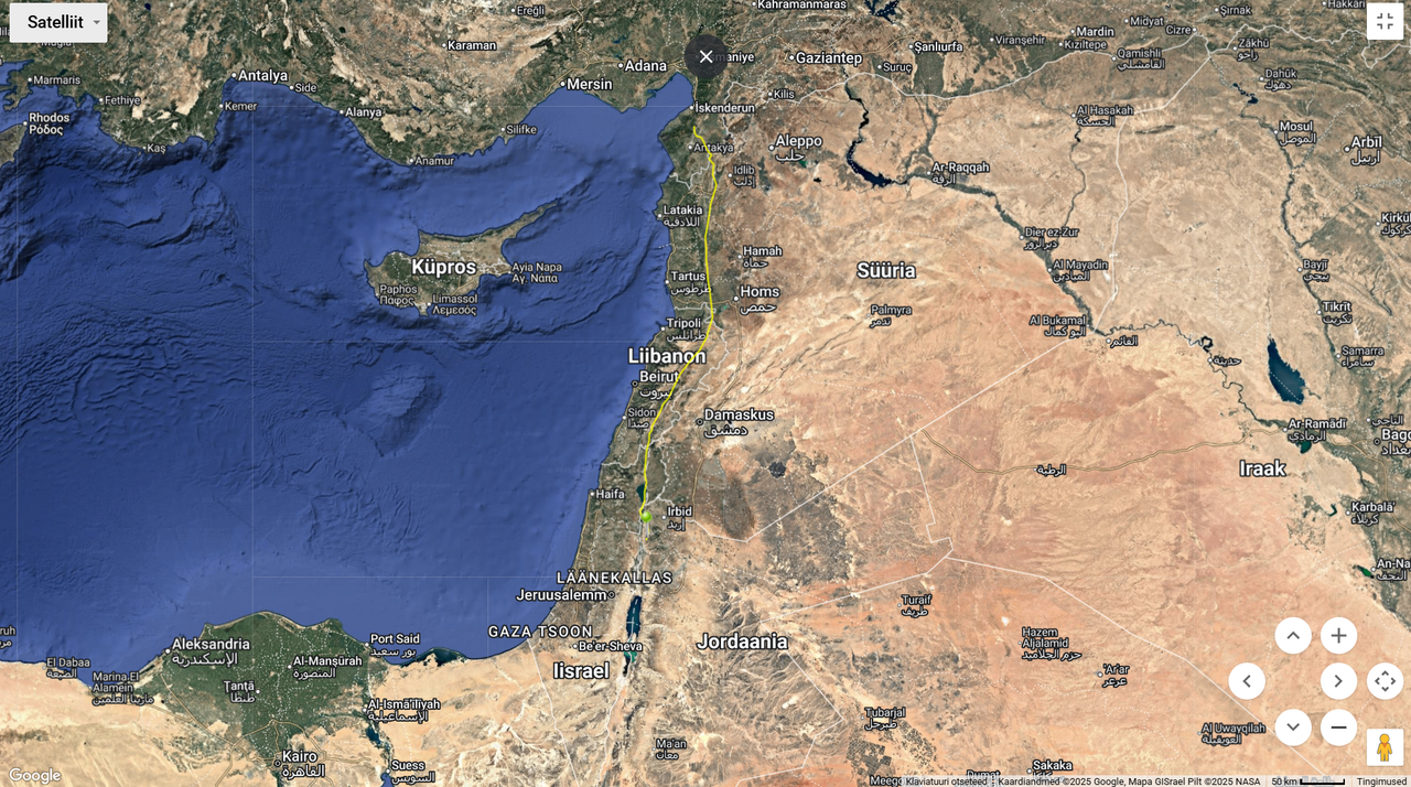
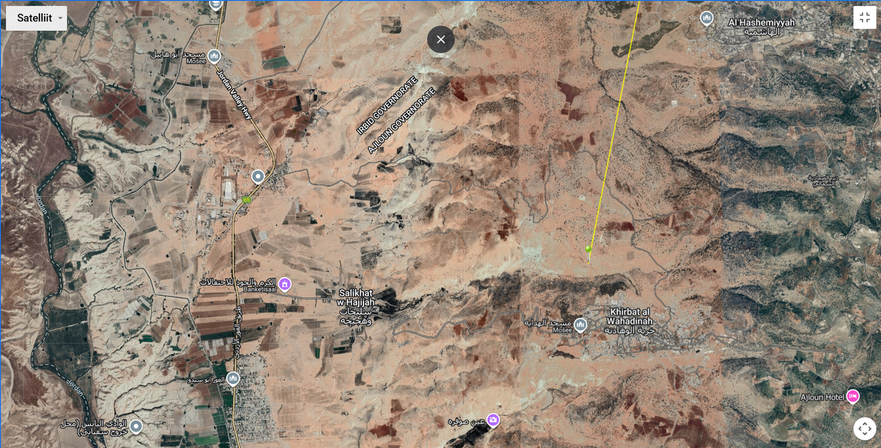
- 10.09, Distance: 5147 km (+ 766 km in 2 days)
- JORDAN: Khirbat al Wahadinah - a village in Ajlun Qasabah District of the Ajloun Governorate
(not far from the border river Jordan)