KRUM - RS Makov (2023)

Post Reply
marika.solo
Site Admin
Posts: 18025
Joined: 29 Sep 2021, 09:38

Re: KRUM - RS Makov (2023)

Post by marika.solo »

June 10
Hello everyone :-)

situation at 04 h UTC

the bridge is named Szapáry híd (híd = bridge)
wiki says: Count Gyula Szapáry de Szapár, Muraszombat et Széchy-Sziget (1 November 1832 – 20 January 1905) was a Hungarian politician who served as Prime Minister of Hungary from 1890 to 1892.

Image

STREET VIEW from the bridge / z mosta https://maps.app.goo.gl/LDKu8bV3HrzKLdUP9 Google Street View Jul 2023

STREET VIEW from the embankment / z násypu https://maps.app.goo.gl/weLTtKgCUHBdYegr5 Google Street View Aug 2022
marika.solo
Site Admin
Posts: 18025
Joined: 29 Sep 2021, 09:38

Re: KRUM - RS Makov (2023)

Post by marika.solo »

view on this area in winter (view to south - there is Krum)

Image
(https://magyarepitok.hu/utepites/2022/0 ... b-szakasza)

view on this area in summer in the time time of construction (view to the south - there is Krum)

Image
(source: https://jnsz.hu/aktualis/2021/07/szapar ... -hamarosan)
marika.solo
Site Admin
Posts: 18025
Joined: 29 Sep 2021, 09:38

Re: KRUM - RS Makov (2023)

Post by marika.solo »

data transmission at 10:38:50 h UTC

- Krum moved northwards, at the time of the data transmission he was flying
- Krum sa pohol smerom na sever, v čase prenosu dát letel

Image
marika.solo
Site Admin
Posts: 18025
Joined: 29 Sep 2021, 09:38

Re: KRUM - RS Makov (2023)

Post by marika.solo »

- at this point Krum flew over the road at 10.32.35
- v tomto bode Krum preletel ponad cestu o 10:32:35

STREET VIEW https://maps.app.goo.gl/6Fgh86fuTFJ3DH1FA Besenyszög, Jász-Nagykun-Szolnok Google Street View May 2021
marika.solo
Site Admin
Posts: 18025
Joined: 29 Sep 2021, 09:38

Re: KRUM - RS Makov (2023)

Post by marika.solo »

next new data transmission only at 22h (UTC)

- again also the previous day despite the correct setting / opäť aj predchádzajúci deň napriek správnemu nastaveniu

- Krum moved not far to the north-west and at 10.36 (UTC) turned back to the previous place
- Krum sa vybral neďaleko smerom na SZ, ale o 10.36 (UTC) sa otočil a priletel späť na predchádzajúce miesto

Image

- night roost (the same like previous days) - I don't know why (it has happened also in the past) we have a symbol of death
- miesto nočného odpočinku (ako predošlé dni) - neviem prečo (stalo sa to aj v minulosti) máme symbol smrti

Image

Szapáry híd Tiszapüspök (in the distance is one of Krum's feeding place there)
Image
STREET VIEW https://maps.app.goo.gl/6UJT8rtxL9vJ5ypY8 Besenyszög, Jász-Nagykun-Szolnok Google Street View Jul 2023
marika.solo
Site Admin
Posts: 18025
Joined: 29 Sep 2021, 09:38

Re: KRUM - RS Makov (2023)

Post by marika.solo »

- at 10.43 Krum flew over the Szapáry híd (híd = bridge), photos in this post: viewtopic.php?p=34234#p34234
- o 10.43 Krum letel ponad most nad riekou Tisou , fotky sú už tu: viewtopic.php?p=34234#p34234

Image
marika.solo
Site Admin
Posts: 18025
Joined: 29 Sep 2021, 09:38

Re: KRUM - RS Makov (2023)

Post by marika.solo »

Image

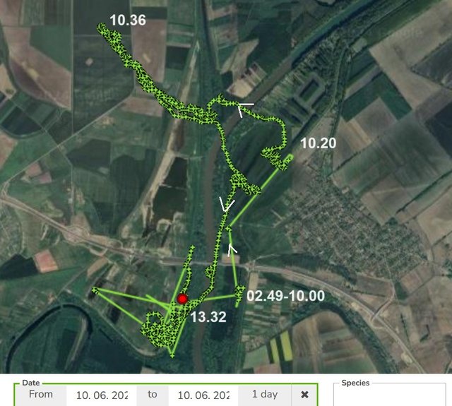
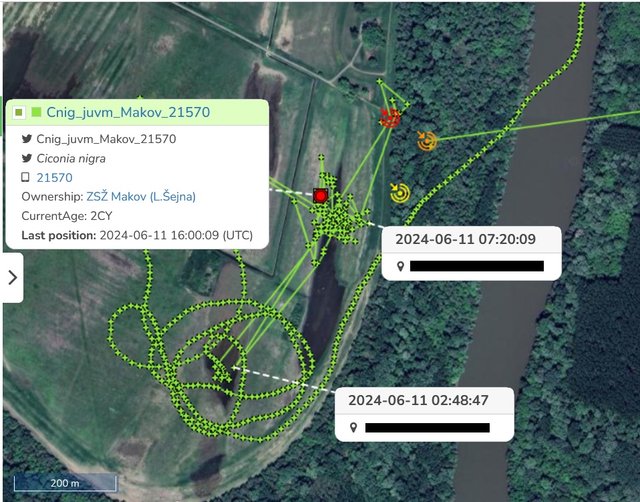
- Krum moves near this interesting place (thanks to geocaching, the box hidden there we have photos from box seekers)
- Krum sa pohybuje v blízkosti tohto zaujímavého miesta (vďaka geocachingu, krabičky tam ukrytej máme fotky od jej hľadačov)

Geocaching is an outdoor recreational activity, in which participants use a Global Positioning System receiver or mobile device and other navigational techniques to hide and seek containers, called geocaches or caches, at specific locations marked by coordinates all over the world.
Geocaching [vyslov: geokešing] (z geo = zem + franc. cache = tajne skryť) je zábava, či určitý druh športu, spočívajúca v hľadaní skrytého objektu, o ktorom sú známe len jeho geografické súradnice. Miesto úkrytu sa nazýva cache – skrýša, schránka – hantírkou keška.


https://geocaching.hu/caches.geo?id=2177&show_logs=i :
1/
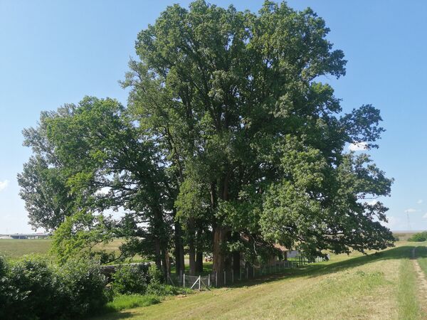
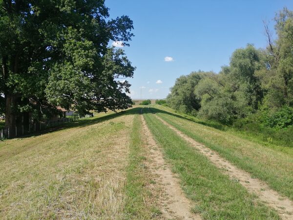
- 13 oaks can be seen in a group near the house of Fokorpuszta former's embankment guard
- 13 dubov je možné vidieť v skupine pri dome bývalého strážcu hrádze Fokorpuszta

2/
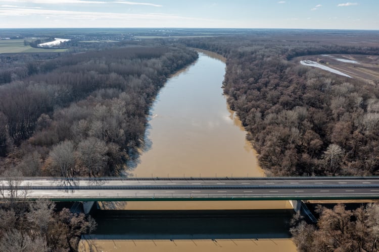
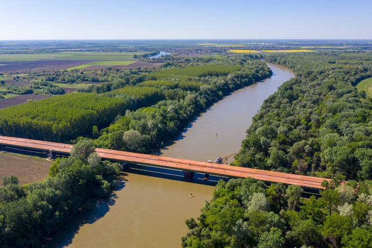
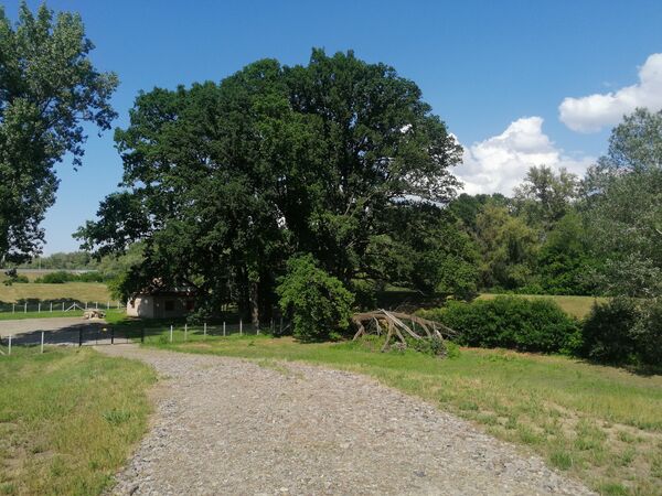
- 27.05.2024 there's no sign of the last flood, it's incredible to think that a short time ago you could only go boating here
- 27.05.2024 po poslednej povodni tu nie je ani stopy, je neuveriteľné, že ešte nedávno sa tu dalo len člnkovať

- The Elisabeth Memorial Trees, or the Elisabeth Trees, after the tragic death of Queen Elisabeth Wittelsbach/Empress Elisabeth of Austria, is the common name of trees planted in the Austro-Hungarian Monarchy in honor of the Queen after her tragic death ... decree of Ignác Darányi, the Minister of Agriculture (also recomended trees) (https://hu.wikipedia.org/wiki/Erzs%C3%A ... 9kf%C3%A1k)
- Pamätné stromy Alžbety alebo stromy Alžbety, po tragickej smrti kráľovnej Alžbety Wittelsbachovej / cisárovnej Alžbety Rakúska, je všeobecný názov stromov vysadených v Rakúsko-Uhorskej monarchii na počesť kráľovnej po jej tragickej smrti ... vyhláška ministra pôdohospodárstva Ignáca Darányiho (aj odporúčané stromy)(https://hu.wikipedia.org/wiki/Erzs%C3%A ... 9kf%C3%A1k)

- one place with remained trees is this one - near Szolnok, to the northeast of the town, near the Tisza
- jedno z miest so zachovanými stromami je toto - pri meste Szolnok, na SV od mesta pri rieke Tisa

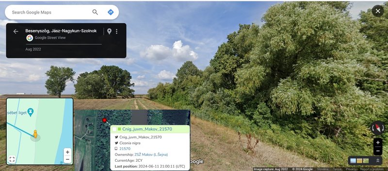
view from the embankment 07.10.2007 (Krum is has localisastions the north on this photo)
Image
https://geocaching.hu/cacheimages/2007- ... 233830.jpg

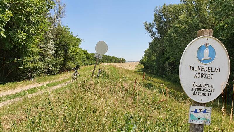
view on the area from the route 07.10.2007
Image
marika.solo
Site Admin
Posts: 18025
Joined: 29 Sep 2021, 09:38

Re: KRUM - RS Makov (2023)

Post by marika.solo »

June 11
Hello everyone :-)

first today data transmission at 16h UTC

- Krum spent the whole day in this place (locations from the previous day are still on the map)
- Krum strávil celý deň na tomto mieste (ešte stále sú na mape aj lokalizácie z predošlého dňa )

Image

STREET VIEW on this area https://maps.app.goo.gl/ejqCkFEp74xjTAGv5 Google Street View Aug 2022
marika.solo
Site Admin
Posts: 18025
Joined: 29 Sep 2021, 09:38

Re: KRUM - RS Makov (2023)

Post by marika.solo »

Image
STREET VIEW https://maps.app.goo.gl/1Nbpe8yUgg15vDH78

info and photos about this area viewtopic.php?p=34325#p34325 and next post

who know - he's spending the night on that drying tree
kto vie - možno trávi noc na tom vyschýnajucom strome
Image
https://geocaching.hu/logimages/2024-06 ... b917ae.jpg

and the opposite view (from N to S) on 18.06.2021
a opačný pohľad (zo S na J) dňa 18.06.2021
Image
https://geocaching.hu/logimages/2021-06 ... 058025.jpg
Post Reply

Return to “Czechia/Makov”