KUREMARI, (fe)male

Post Reply
marika.solo
Site Admin
Posts: 17997
Joined: 29 Sep 2021, 09:38

Re: KUREMARI, (fe)male

Post by marika.solo »

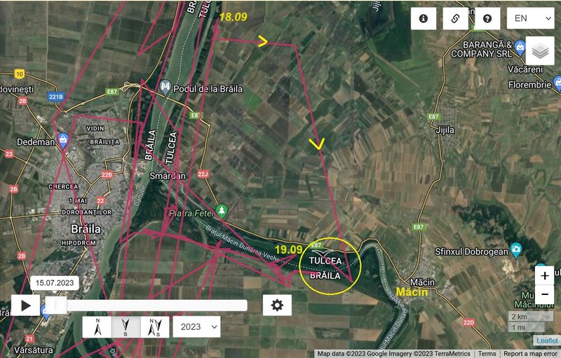
birdmap update 18.09.2023

NEW data:
- 18.09.2023, Distance: 2236 km (+ 26 km)
- ROMANIA: to the north from Smârdan - a village in Tulcea County
(Western Moldavia)

Kuremari moved from the Calia Island to the north. Newest localisation is to the east from the Island "Insula de pe Dunare" or "Insula Veriga" on the floodplain between river bank and the anti-flood embankment.

there are illustrations - view on this area viewtopic.php?p=24443#p24443

Image

Image
marika.solo
Site Admin
Posts: 17997
Joined: 29 Sep 2021, 09:38

Re: KUREMARI, (fe)male

Post by marika.solo »

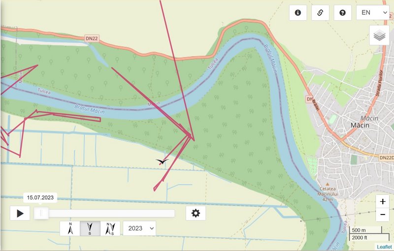
birdmap update 19.09.2023

NEW data:
- 19.09.2023, Distance: 2253 km (+ 17 km)
- ROMANIA: to the west from Măcin - a a town in Tulcea County
(Northern Dobruja region)

Kuremari moved from area to the west from the Island "Insula de pe Dunare" or "Insula Veriga" (floodplain between river bank and the anti-flood embankment) to the south-east - Dunărea Veche (Braţul Măcin) / Old Danube (Măcin Arm).

Dunărea Veche (Braţul Măcin): https://ro.wikipedia.org/wiki/Dun%C4%83 ... M%C4%83cin

info about this area:
It is Important Bird Area - IBA (http://datazone.birdlife.org/site/facts ... ba-romania) and Ramsar Site (https://rsis.ramsar.org/ris/2116): The site is part of the Danube meadow and is situated in an important migration corridor, providing breeding, resting and feeding shelter for many bird species. The landscape is characterized by lakes between sand dunes, marshes, shrub wetlands, fishponds, islands, canals and drainage channels all very rich in biodiversity. Belong to Natura 2000 sites (https://eunis.eea.europa.eu/sites/ROSPA0040)

You can see on this map the whole area and how the Great Brăila Island changed :-( - https://rsis.ramsar.org/RISapp/files/36 ... 116map.pdf.
(There was a series of swamps – Brăila Pond/Balta Brăilei, until the Communist regime drained them and built dams and transformed it to an agricultural area. - wiki)

PHOTOS Old Danube (Măcin Arm) e.g. here https://www.info-delta.ro/bratul-macin- ... rii-vechi/
marika.solo
Site Admin
Posts: 17997
Joined: 29 Sep 2021, 09:38

Re: KUREMARI, (fe)male

Post by marika.solo »

Image

Image
marika.solo
Site Admin
Posts: 17997
Joined: 29 Sep 2021, 09:38

Re: KUREMARI, (fe)male

Post by marika.solo »

Image

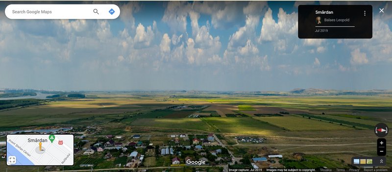
in this VIDEO we see the area where Kuremari flew for the night resting (start) and the whole path to the new place (min. 4:55 and next) (the bridge had not been built at that time)


or on this STREET VIEW - you can rotating the view and see the whole path (the bridge had not been built at that time)
Image

https://maps.app.goo.gl/MiJNnGa8zMzYJKUm6 uploaded by Balaes Leopold - Jul 2019
marika.solo
Site Admin
Posts: 17997
Joined: 29 Sep 2021, 09:38

Re: KUREMARI, (fe)male

Post by marika.solo »

Image

Image

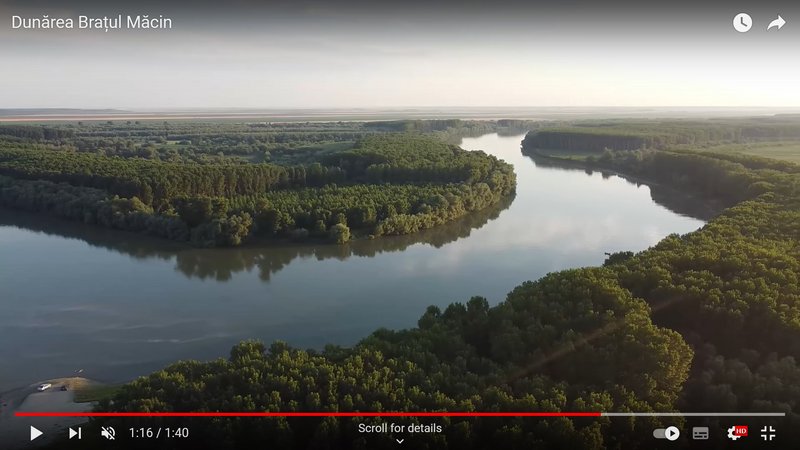
pic from VIDEO Dunărea Brațul Măcin

uploaded on 28 Jun 2021 by Dan Staicu
marika.solo
Site Admin
Posts: 17997
Joined: 29 Sep 2021, 09:38

Re: KUREMARI, (fe)male

Post by marika.solo »

birdmap update 20.09.2023

NEW data:
- 20.09.2023, Distance: 2258 km (+ 5 km)
- ROMANIA: to the west from Măcin - a a town in Tulcea County
(Northern Dobruja region)

Kuremari stayed in the new area - Old Danube (Măcin Arm).

Image

Image
marika.solo
Site Admin
Posts: 17997
Joined: 29 Sep 2021, 09:38

Re: KUREMARI, (fe)male

Post by marika.solo »

birdmap update 21.09.2023

NEW data:
- 22.09.2023, Distance: 2305 km (+ 47 km)
- ROMANIA: to the south-east from Măcin - a a town/or to the north-west from Carcaliu - a commune (single village) in Tulcea County
(Northern Dobruja region)

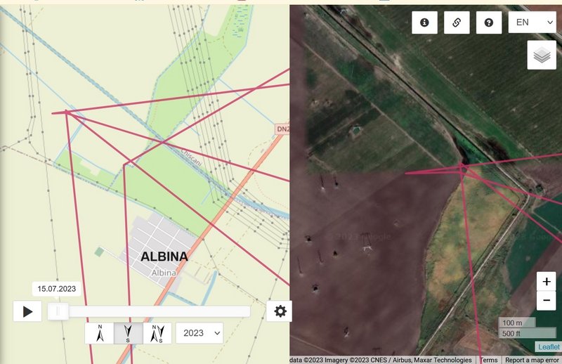
Kuremari flew to the east from the Small Brăila Island (again to Albina area around midday- loc. there already on 30.08 and 02.09) and back on the Big/Great Brăila Island (to the Old Danube - Măcin Arm).

Image

Image
marika.solo
Site Admin
Posts: 17997
Joined: 29 Sep 2021, 09:38

Re: KUREMARI, (fe)male

Post by marika.solo »

Image

Image
marika.solo
Site Admin
Posts: 17997
Joined: 29 Sep 2021, 09:38

Re: KUREMARI, (fe)male

Post by marika.solo »

street view - Kuremari visited this canal area (Albina) in the distance
it is the view to the east https://maps.app.goo.gl/mJpNca2hn5knKMtv7 and to the west/there Kuremari flew https://maps.app.goo.gl/XJF4VxsUPemLBvEFA

Image

street view - there is the path-line to Albina and back above the route on the Big/Great Brăila Island
https://maps.app.goo.gl/qsbdUFWdgUx82Cco9 (flat fields area)

view on the Big/Great Brăila Island
Image
pic from VIDEO "Is the Big Island of Brăila sold to foreigners?" https://youtu.be/lxgQFngmyYE?feature=shared uploaded on 15 Jun 2023 by Lumea Satului TV
Post Reply

Return to “Latvia”