January 22
Hello everyone

Birdmap update for
WABA https://birdmap.5dvision.ee/EN/2022/aut ... =0&speed=1
Previous data:
(viewtopic.php?p=11314#p11314 and next)
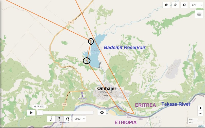
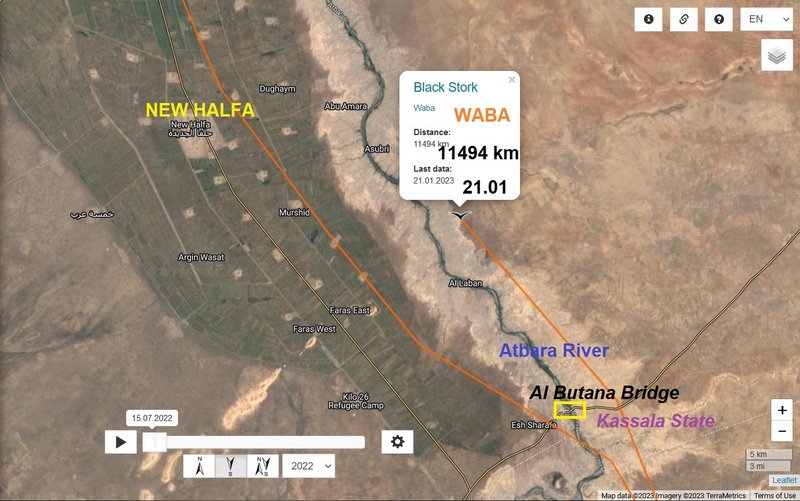
- 21.01.2023, Distance: 11 494 km (
+ 710 km in 4 days)
- SUDAN: Al Laban - Kassala State
NEW data:
- 22.01.2023, Distance: 11 551 km (
+ 57 km)
- SUDAN: Degheim - New Halfa subdivision, Nahr Atbara district of Kassala state
Waba crossed the Atbarah river and continued above the irrigated fields area. Lines are south from Degheim. The newest (mid-flight) data are near the "Village 24" (Qaryah Arba'ah wa 'Ishrun).
The New Halfa Project in Sudan is a 164,000 feddan site constructed in 1964 to house 50,000 Nubians displaced from Wadi Halfa, a town situated on the Nile near the border with Egypt, which was flooded when Lake Nasser formed behind the Aswan Dam. The site draws its water from the Atbara River, where the Khashm el Girba Dam provides a reliable source for the irrigation project intended to convert the nomads of the area to farmers of cotton and sugar. https://en.wikipedia.org/wiki/New_Halfa_Scheme;
if you are more interested: Wallin, M. (2014). Resettled for Development. The Case of New Halfa Agricultural Scheme, Sudan. https://www.diva-portal.org/smash/get/d ... 01.pdf%24x) ... "The 50,000 Nubians originally resettled were placed in either pre-built brick houses constructed in 25 villages in the scheme area, or in the town of New Halfa itself."
(A feddan is a unit of area used in Egypt, Sudan, Syria, and the Oman. 1 feddan = 4200 m²/ 0.420 ha)
"... New Halfa Wadi Agricultural Scheme which is agricultural settlement scheme of 183,333 Hectare. The actual total area for the project including sugar factory is 248,750 Hectare. ... The crops growing in Atbra agriculture scheme are mainly akala cotton, groundnuts, wheat, sugar cane and vegetables. The project was designed to use water from Khashm El-Girba reservoir that located at Atbara River." https://www.sciencedirect.com/science/a ... 2322000163)