Previous data viewtopic.php?p=52246#p52246
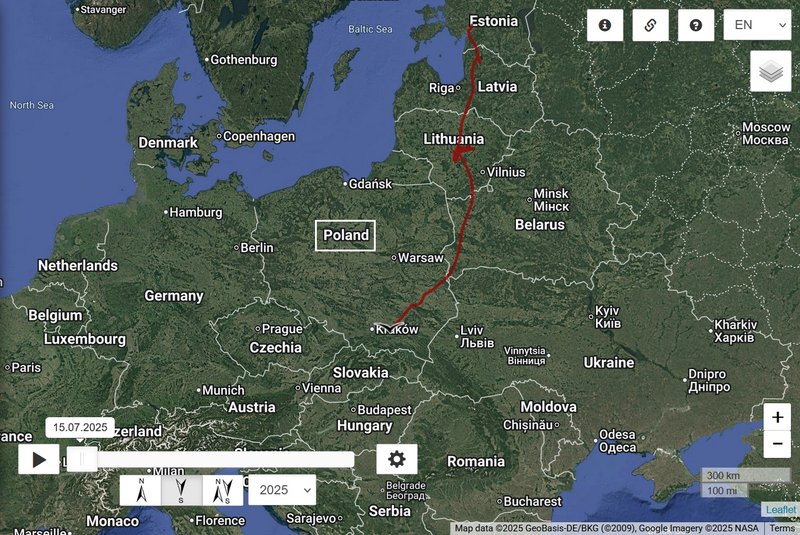
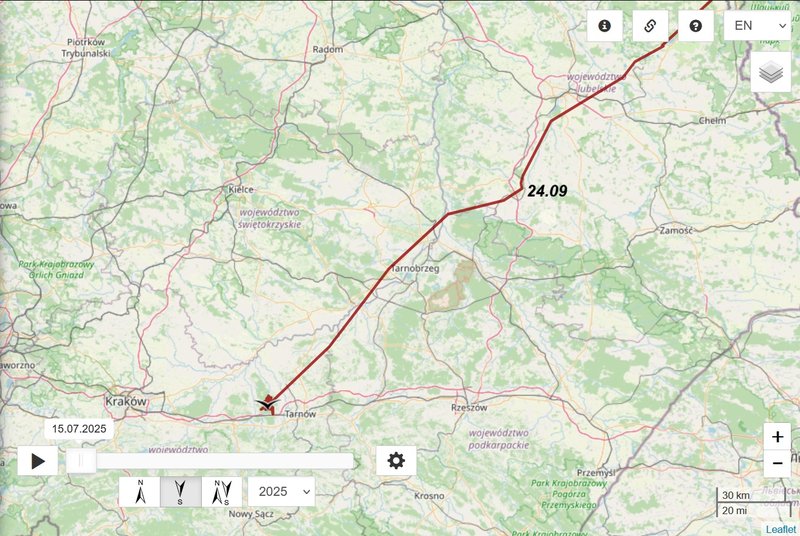
- 24.09, Distance: 1682 km (+ 203 km)
- POLAND: Karpiówka - a village in the administrative district of Gmina Kraśnik, within Kraśnik County, Lublin Voivodeship, in eastern Poland
Previous data
- 24.09, Distance: 1682 km (+ 203 km)
- POLAND: Karpiówka - a village in the administrative district of Gmina Kraśnik, within Kraśnik County, Lublin Voivodeship, in eastern Poland
Previous data viewtopic.php?p=52246#p52246
- 24.09, Distance: 1682 km (+ 203 km)
- POLAND: Karpiówka - a village in the administrative district of Gmina Kraśnik, within Kraśnik County, Lublin Voivodeship, in eastern Poland
NO NEW data
Urmas: Iksi has older refurbished transmitter with GSM 2G. 2G system is going to be dismantled in some regions earlier. Therefore transmission could be not everywhere possible.
If we receive new information, we will inform you immediately.
Previous data
- 24.09, Distance: 1682 km (+ 203 km)
- POLAND: Karpiówka - a village in the administrative district of Gmina Kraśnik, within Kraśnik County, Lublin Voivodeship, in eastern Poland
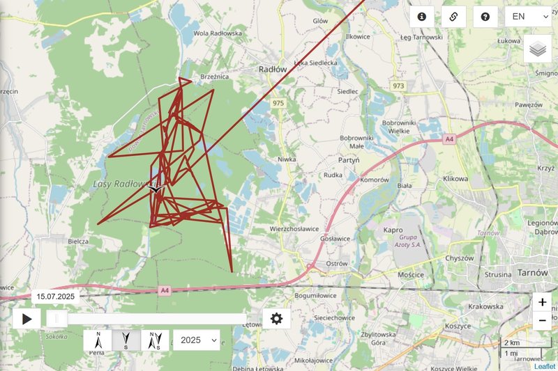
- 25.09 Iksi moved to the new area/Radlowskie Forest
NEW data
- 07.10 (!), Distance: 1935 km (+ 253 km in 13 days)
- POLAND: Lasy Radlowskie - Wierzchosławice district in Tarnów County, Lesser Poland Voivodeship, in southern Poland
"Lasy Radłowskie Reserve is mainly composed of oak- and pine-dominated forests, with areas containing birch, hornbeam, alder, willow and lime tree. Both older and younger parts make a diverse environment for animals and plants. With a mosaic of man-made water reservoirs and fishponds it is also full of water-dependant organisms, especially birds, both local and migratory." https://www.birdingplaces.eu/pl/birding ... ie-reserve
Previous data
- 07.10 (!), Distance: 1935 km (+ 253 km in 13 days)
- POLAND: Lasy Radlowskie - Wierzchosławice district in Tarnów County, Lesser Poland Voivodeship, in southern Poland
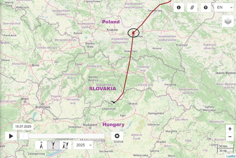
NEW data travelling day
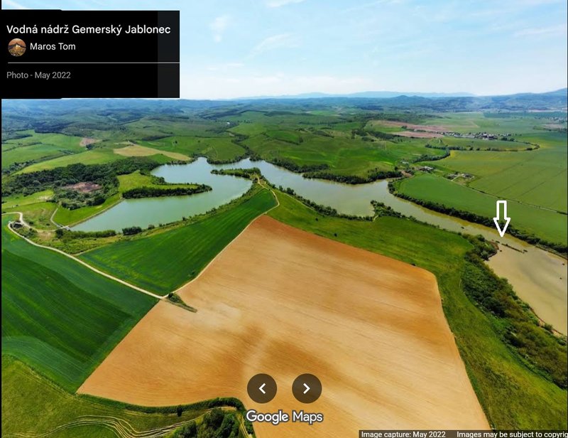
- 13.10, Distance: 2157 km (+ 222 km)
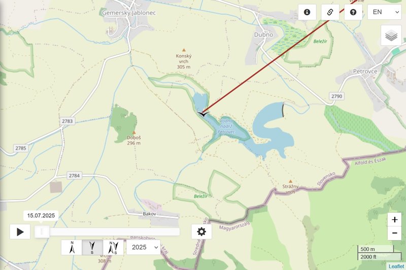
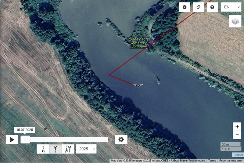
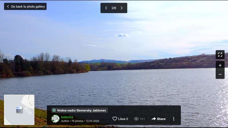
- SLOVAKIA: Gemerský Jablonec Water Reservoir - Rimavská Sobota district of the Banská Bystrica Region
Iksi today left Lasy Radłowskie (PL), crossed Slovakia and already reached the Hungarian border. Newest localisation is in one water reservoire (it is not his final localisation today).
The Gemerský Jablonec Water Reservoir is a nature reserve managed by the Cerová vrchovina State Nature Protection. It is located in the cadastral territories of the municipalities of Dubno, Gemerský Jablonec, and Petrovce in the Rimavská Sobota District of the Banská Bystrica Region
- IUCN: Ia; 32,0290 ha; 5th level of protection; since 2000
- The Nature Reserve is declared to ensure the protection of an important trophic, reproductive and migratory site for waterfowl. ...
- Protective Zone up to a distance of 100 meters outward from the boundary of the protected area; 3rd level of protection ... (https://data.sopsr.sk/chranene-objekty/ ... etail/1091)
What is a "trophic site"? In the context of nature conservation, a trophic site is an area where animals find food. The water reservoir that Iksi reached is a protected nature reserve, important not only for feeding (trophic) but also for breeding (reproductive) and resting during migration (migratory site). When we say it’s a “trophic site,” we mean it provides rich feeding opportunities — like fish, amphibians, or invertebrates — that are vital for the birds, especially during long journeys like migration.
The water reservoir was built in 1990 and put into operation in 1991. The reservoir was created by damming the Gortva watercourse west of the village of Petrovce, and it has an irregular (articulated) ground plan shape. The total volume of the reservoir is 2,490,000 m³, and the usable volume is 1,925,400 m³. At maximum water level, the flooded area covers 62.5 hectares. (https://najkrajsikraj.sk/vodna-nadrz-ge ... ezervacia/)
