BS with transmitter from nest in RS Makov (to 31.12.2021)

Post Reply
marika.solo
Site Admin
Posts: 11595
Joined: 29 Sep 2021, 09:38

Re: BS with transmitter from CZECHIA

Post by marika.solo »

BLUE public map https://www.makov.cz/clanky/telemetrie-makov-24.html
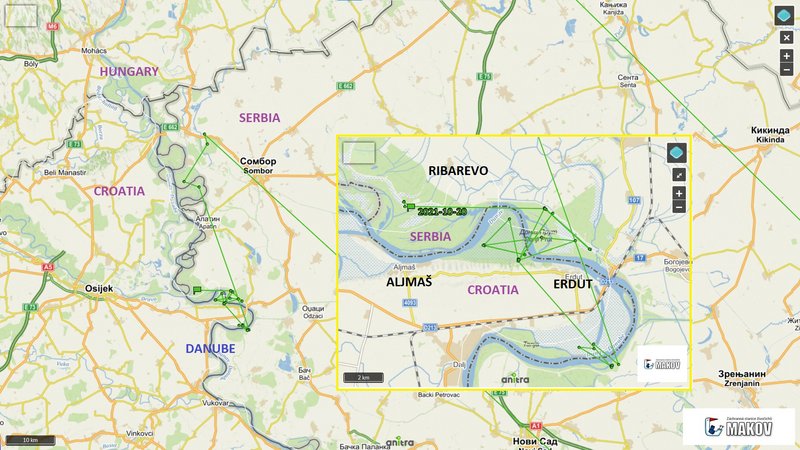
(previous post viewtopic.php?p=263#p263 and next)

(description later - done)

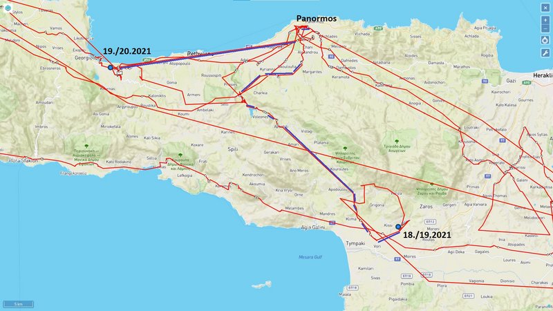
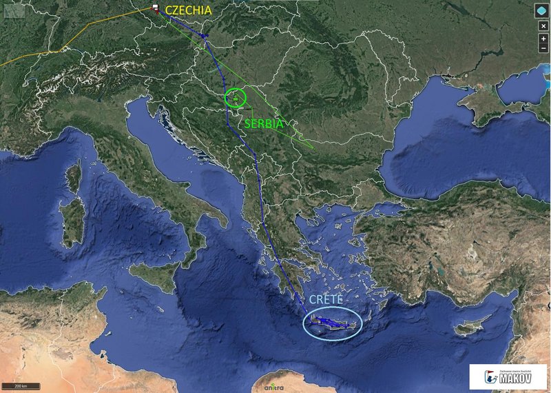
discovering Crete on 19.10.

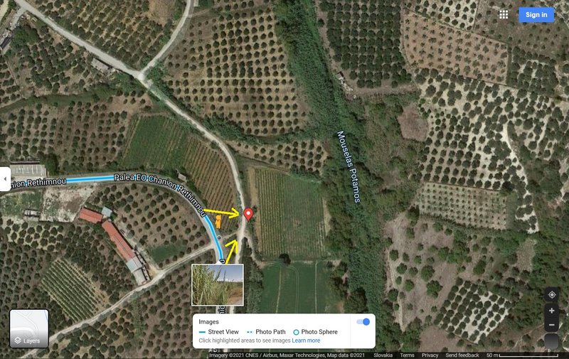
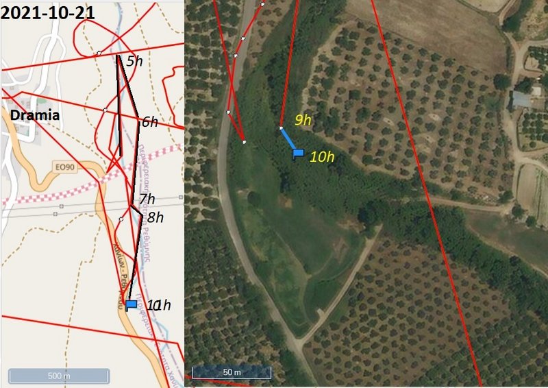
Blue spendt the night in the Faneromeni Dam Lake area. In the morning continued to the NW, at the noon change the direction
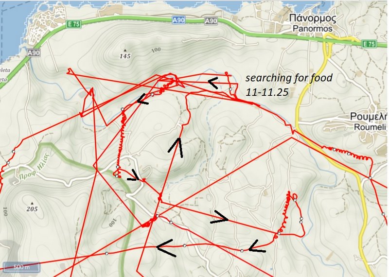
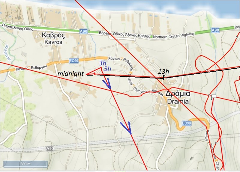
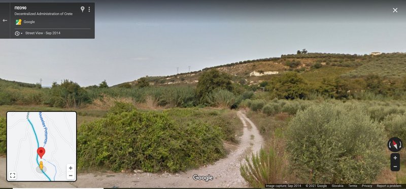
to NE (to Panormos). South from Panormos Blue was looking for food in the Milopotamos River. After half an hour stork continued west along the coast to Dramia (south from Kavros). There stork stayed and spent the night.


Image

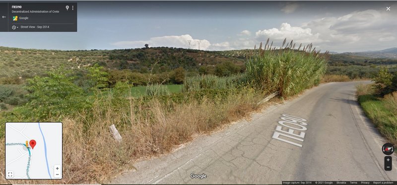
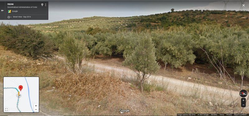
south from Panormos Blue was looking for food in the Milopotamos River; after half an hour stork continued west along the coast to Dramia
Image

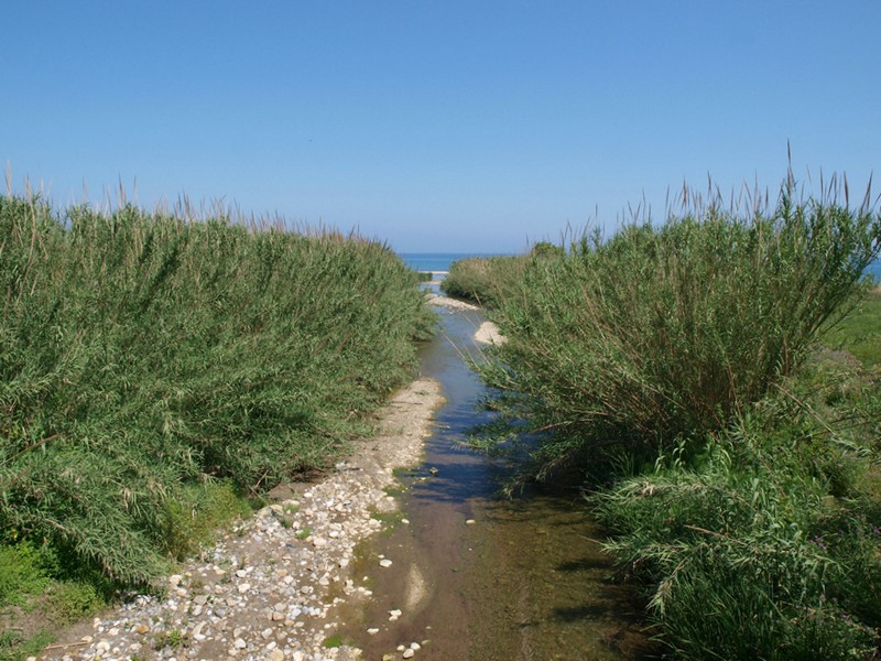
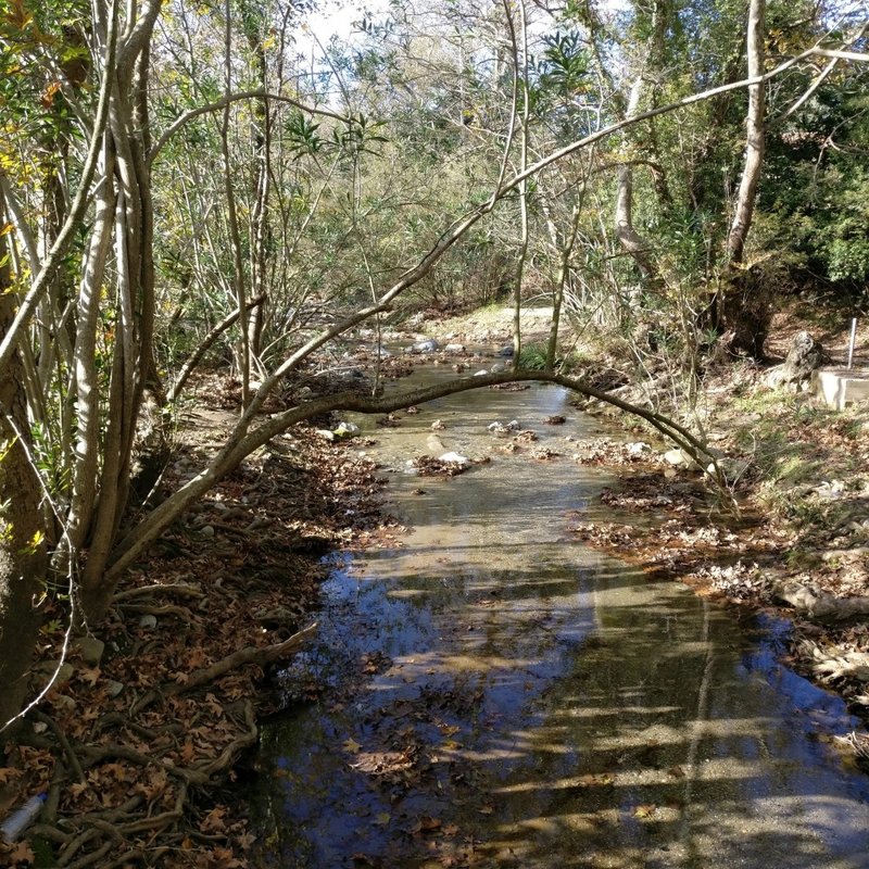
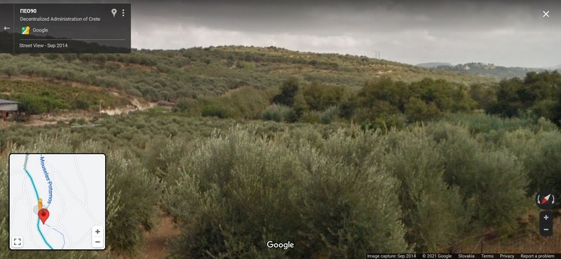
feeding area (river Geopotamos Potámos/Milopotamos)
Image

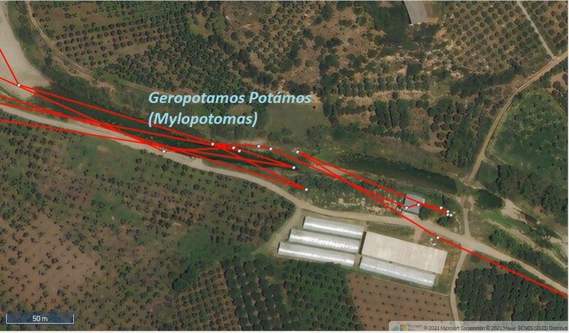
Geropotamos and Milopotamos rivers
Geropotamos in Rethymno is a long river that flows into the beach of Geropotamos, at the site of ancient Avlona, where it forms an important wetland. Its name means "sacred river", while near its exit it is also known as Avlopotamos due to the ancient city Avlona. Geropotamos gathers the waters from many tributaries on the northern side of Psiloritis.
Shortly before emptying in the sea, it joins with the river Margaritsanos or Mylopotamos, which owes its name to the many watermills that once operated along the way. Mylopotamos river gathers its waters from the area of Margarites and ancient Eleftherna. Mylopotamos is so important for the region that the entire province of Mylopotamos has been named after it.

https://www.cretanbeaches.com/en/rivers ... -rethymnon
marika.solo
Site Admin
Posts: 11595
Joined: 29 Sep 2021, 09:38

Re: BS with transmitter from CZECHIA

Post by marika.solo »

BLUE - continuation

after half an hour stork continued west along the coast to Dramia (south from Kavros) - there stork stayed and spent the night.

Image

Image

EDIT:
data from midday (20.10.2021) - https://i.postimg.cc/8zCYPpSB/2021-10-2 ... t-data.jpg
data from 16h (20.10.2021) https://i.postimg.cc/G3jsYvDx/2021-10-2 ... it-16h.jpg
marika.solo
Site Admin
Posts: 11595
Joined: 29 Sep 2021, 09:38

Re: BS with transmitter from CZECHIA

Post by marika.solo »

October 21
Hello everyone :-)


GREEN is still in the same (newest) area, it is still the Gornje Podunavlje Special Nature Reserve (Serbia)
BLUE is exploring Crete every day

situation on the simplified public map (one day delay 2021-10-20)

Image

Image
marika.solo
Site Admin
Posts: 11595
Joined: 29 Sep 2021, 09:38

Re: BS with transmitter from CZECHIA

Post by marika.solo »

GREEN public map https://www.makov.cz/clanky/telemetrie-makov-24.html
(previous update viewtopic.php?p=295#p295)

stork is still in the same (newest) area, it is still the Gornje Podunavlje Special Nature Reserve (Serbia)

localisations are east from the confluence Drava - Danube (on the left bank of the Danube), not far to the south from Ribarevo (lodging) - Apatin, Serbia, respectively north from Aljmaš - a village in the Erdut municipality in eastern Croatia (Aljmaš lies on the right bank of the Danube)

after yesterday's all-day movement in a very small area (and the stork spent the night there again), this morning he flew a little further west
(Green is most probably still O.K. :-) )

Image

Image
marika.solo
Site Admin
Posts: 11595
Joined: 29 Sep 2021, 09:38

Re: BS with transmitter from CZECHIA

Post by marika.solo »

BLUE sent data :-)
later more - done

BLUE public map https://www.makov.cz/clanky/telemetrie-makov-24.html
(previous post viewtopic.php?p=300#p300 and next)

discovering Crete on 20.10.

BLUE moved along the Moselas River (east from Darmia) all day yesterday (Oct 20)

data from midday (20.10.2021) - https://i.postimg.cc/8zCYPpSB/2021-10-2 ... t-data.jpg
data from evening - sit 16h (20.10.2021) https://i.postimg.cc/G3jsYvDx/2021-10-2 ... it-16h.jpg

Image

River Mouselas
The river Mouselas flows through the valleys that form east of the White Mountains and flows into the western boundary of the long beach of Episkopi, in the large bay of Almyros that has the most rivers in Crete.
more (aslo photos) eg here https://www.cretanbeaches.com/en/rivers ... r-mouselas

the river very near the seaImage
PHOTO https://www.cretanbeaches.com/images/st ... 20exit.jpg
marika.solo
Site Admin
Posts: 11595
Joined: 29 Sep 2021, 09:38

Re: BS with transmitter from CZECHIA

Post by marika.solo »

BLUE contiuation

the localisation of the stork at midnight (the red symbol) isn't visible from the road

Image

- the first view from NW to SE to his night-resting place
STREET VIEW https://goo.gl/maps/ghS1JkMe6bDgRKfV9 image capture Sep 2014
Image

- the second view from SE to NW to his night-resting place
STREET VIEW https://goo.gl/maps/T4zRwuPvQZmkvLNF7 image capture Sep 2014 (when zoomed in, you see a small river behind the fence)
Image
marika.solo
Site Admin
Posts: 11595
Joined: 29 Sep 2021, 09:38

Re: BS with transmitter from CZECHIA

Post by marika.solo »

BLUE continuation

Mouselas River - crete by phyla photo journal, travelling, crete - November 15, 2016 (https://cretebyphyla.wordpress.com/2016 ... las-river/)

"When I was in search of Apopigadi, I was looking for this water feeling. You cannot walk exactly all the way by the river, as the land is privately owned and separated with fences at points (last photo)."

one of these photos
Image
marika.solo
Site Admin
Posts: 11595
Joined: 29 Sep 2021, 09:38

Re: BS with transmitter from CZECHIA

Post by marika.solo »

October 22
Hello everyone :-)


GREEN is still in the same (newest) area, it is still the Gornje Podunavlje Special Nature Reserve (Serbia)
BLUE is exploring Crete every day

situation on the simplified public map
Image

situation on the Anitra map
Image
marika.solo
Site Admin
Posts: 11595
Joined: 29 Sep 2021, 09:38

Re: BS with transmitter from CZECHIA

Post by marika.solo »

GREEN public map https://www.makov.cz/clanky/telemetrie-makov-24.html
(previous update viewtopic.php?p=315#p315)

stork is still in the same (newest) area, it is still the Gornje Podunavlje Special Nature Reserve (Serbia)

localisations are east from the confluence Drava - Danube (on the left bank of the Danube), not far to the south from Ribarevo (lodging) - Apatin, Serbia, respectively north from Aljmaš - a village in the Erdut municipality in eastern Croatia (Aljmaš lies on the right bank of the Danube)

the weather isn't favourable (rain) - it can be the reason for the moving only in one little place the last days

Image

Image
marika.solo
Site Admin
Posts: 11595
Joined: 29 Sep 2021, 09:38

Re: BS with transmitter from CZECHIA

Post by marika.solo »

BLUE public map https://www.makov.cz/clanky/telemetrie-makov-24.html
(previous update viewtopic.php?p=316#p316 and next)

last data: 2021-10-21 10:00:11 (UTC)

Image

view to his fishing/food searching area (from SE to NW)
Image
STREET VIEW https://goo.gl/maps/5Ax1wLDabR5386sq8 image capture Sep 2014

view to his fishing/food searching area (from NW to SE)
Image
STREET VIEW https://goo.gl/maps/rqACx7gLa4pL3kVy5 image capture Sep 2014
Post Reply

Return to “Czechia”