continuation
edit:
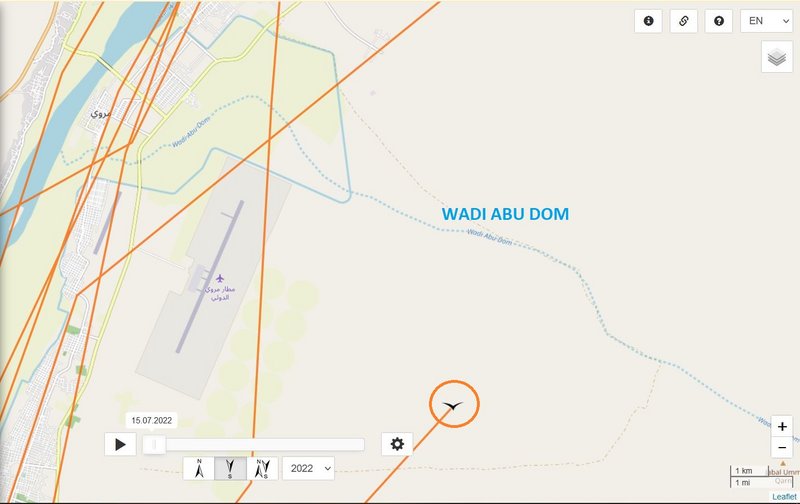
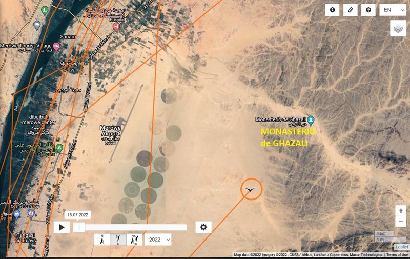
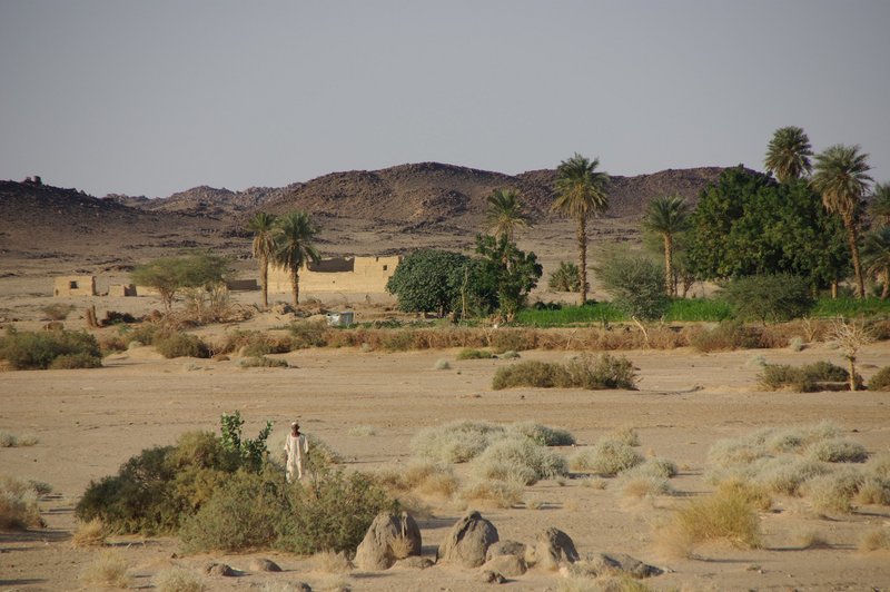
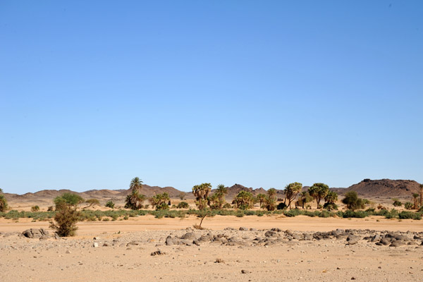
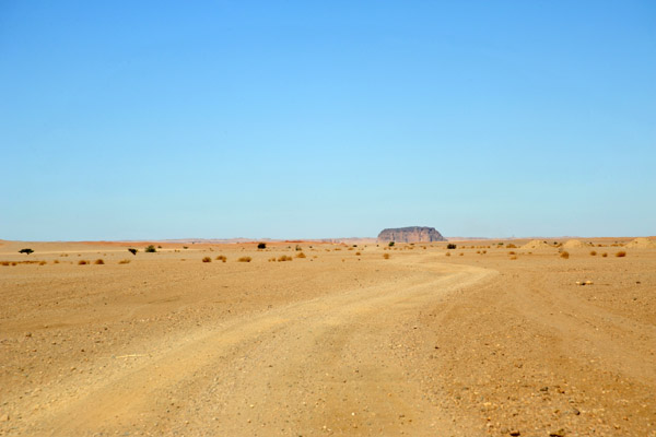
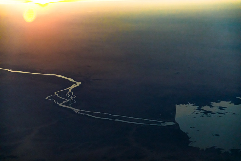
The Wadi Abu Dom is one of the largest valleys of the Bayuda Desert. Whereas the wadi itself is in general a wide sandy plain, there are rocky areas consisting of flat out crops and even hills that influence the (river)bed. The dendritic offspring of the Wadi Abu Dom is situated in the rocks of Ras ed-Dom south-west of the Bayuda volcano field. It flows around the Jebel Sultaniya in a roughly western direction, near Bir Merwa it changes its direction to north-west, and near Umm Beida it again flows in a sharp bend in a roughly western direction. The part of the Wadi between its offspring and Bir Merwa is defined as the upper Wadi Abu Dom, the part from Bir Merwa to Umm Beida as the middle, and the part from Umm Beida to the Nile River as the lower Wadi Abu Dom. (source: https://www.degruyter.com/document/doi/ ... ml?lang=en)
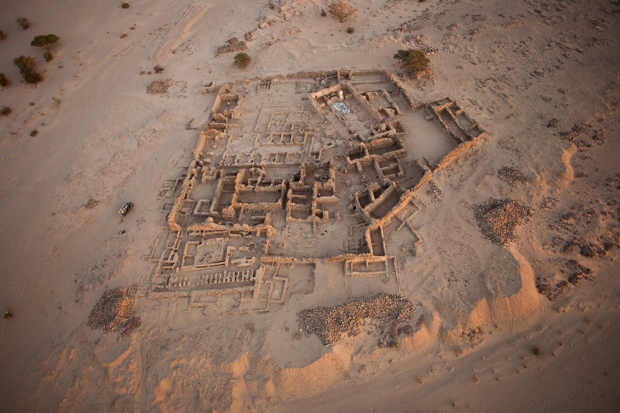
information are also e.g. here http://wadi-abu-dom.de/wp-content/uploa ... educed.pdf (project site http://en.wadi-abu-dom.de/)
WABA, hatched 2022, streamed nest in Karula NP
-
- Site Admin
- Posts: 11817
- Joined: 29 Sep 2021, 09:38
-
- Site Admin
- Posts: 11817
- Joined: 29 Sep 2021, 09:38
Re: WABA, hatched 2022, streamed nest in Karula NP
continuation
The monastery of Ghazali is situated in the lower part of the Wadi Abu Dom, about 15 kilometres from the Nile, opposite Jebel Barkal. It dates from the 10th century AD, when Nubian Christianity was at its height, and is a good example of monasticism in this period.
Due to its remote location, various types of construction at the site are exceptionally well preserved. The monastery was surrounded by a strong enclosure wall built of schist slabs into which entrances are situated in the north and west walls. The main feature inside the walled area is a church built of mudbricks which rests on lower courses of dressed sandstone blocks. Its interior is plastered and covered in graffiti. Only recently, a second smaller church was discovered south of the larger structure. Other excavated buildings include refectories with circular benches, the layout of which follows a common Eastern Orthodox tradition, monks' cells and a set of latrines.
A substantial cemetery south of the monastery doubtlessly served as the burial ground of the monks. The graves were organised in rows and marked by box-shaped superstructures built of stone slabs. In this period, tomb stones took the shape of rectangular pottery plates with an incised funerary prayer. Many of those from Ghazali were written in Coptic, indicating that the congregation may have included Egyptian monks who had fled to Nubia from persecution in their homeland.
Other components of the site include an extramural settlement and a production area with iron smelting furnaces. (source https://www.discoversudan.de/en/travel/ ... ns/ghazali)
interesting information are e.g. here
Polish Centre of Mediterranean Archaeology, University of Warsaw (https://pcma.uw.edu.pl/en/2019/03/19/ghazali-2/)
1/ http://nubianmonasteries.uw.edu.pl/ghazali/ also photo gallery (7 albums) http://nubianmonasteries.uw.edu.pl/gallery/
2/ https://virtualnubia.uw.edu.pl/ghazali-monastery also virtual tour and guided tour http://nubianmonasteries.uw.edu.pl/virtual-tour/
big PHOTO http://nubianmonasteries.uw.edu.pl/wp-c ... G_3026.jpg (source http://nubianmonasteries.uw.edu.pl/ghazali/)
one very nice view on the Ruined Coptic Christian church at the Monastery of Ghazali by © Eric Lafforgue (All rights reserved ) - click for view https://flic.kr/p/ecuNP9
and the oasis there (Halte dans l'oued Abu Domm pour visiter le monastère de Ghazali - Stop in the Abu Domm wadi to visit the Ghazali monastery
PHOTO https://lh5.googleusercontent.com/p/AF1 ... ATLT=h1440 by Olivier Morice
-
- Site Admin
- Posts: 11817
- Joined: 29 Sep 2021, 09:38
Re: WABA, hatched 2022, streamed nest in Karula NP
continuation
much photos also here https://pbase.com/bmcmorrow/ghazali&page=2 (Images are Copyright Brian J. McMorrow, taken on 11.12.2009)
some of them - the wider area views
We finally got caught up on our itinerary and had extra time...
Oasis at Ghazali
Jebel Barkal, a beacon across the desert
much photos also here https://pbase.com/bmcmorrow/ghazali&page=2 (Images are Copyright Brian J. McMorrow, taken on 11.12.2009)
some of them - the wider area views
We finally got caught up on our itinerary and had extra time...
Oasis at Ghazali
Jebel Barkal, a beacon across the desert
-
- Site Admin
- Posts: 11817
- Joined: 29 Sep 2021, 09:38
Re: WABA, hatched 2022, streamed nest in Karula NP
thank you Adriána , nice view on the area!Adria wrote: ↑28 Nov 2022, 21:52... Photo Street View Jiří Chaloupka 1/2019 https://goo.gl/maps/E7u9oV28CsEfssfc8 ...
-
- Site Admin
- Posts: 11817
- Joined: 29 Sep 2021, 09:38
Re: WABA, hatched 2022, streamed nest in Karula NP
November 29
Hello everyone
Birdmap update for WABA https://birdmap.5dvision.ee/EN/2022/aut ... =0&speed=1
Previous data: (viewtopic.php?p=11020#p11020 and next)
- 28.11.2022, Distance: 8140 km (+ 53 km)
- SUDAN: Merowe - Northern State
NEW data:
- 29.11.2022, Distance: 8262 km (+ 122 km)
- SUDAN: Samareit - Magasi, Northern State
Waba flew to the north to the Merowe Reservoire and after night resting there flew back to the south. Newest localisation is south from Samareit (north from Magasi) above the palm orchards.
Re: WABA, hatched 2022, streamed nest in Karula NP
continuation
Re: WABA, hatched 2022, streamed nest in Karula NP
continuation
Waba continued to the north and the night of 28.11. on 29.11. spent on the east coast of the Merowe reservoir.
A view of the area where Waba spent the night.
Photo Jacques taberlet 11/2003 https://goo.gl/maps/B3zyx9wudD8u3dyY7
Morning 29.11. Waba turned south again. The last position is near the town of Samareit.
-
- Site Admin
- Posts: 11817
- Joined: 29 Sep 2021, 09:38
Re: WABA, hatched 2022, streamed nest in Karula NP
continuation
view on Waba's trip area
Merowe Dam, also known as Hamdab Dam and the river Nile there
- https://flic.kr/p/QnMBAV (already posted) taken in July 2014 by GRID-Arendal
and next view
- https://flic.kr/p/2n8PeyD, taken on February 23, 2022 by Ninara
view on Waba's trip area
Merowe Dam, also known as Hamdab Dam and the river Nile there
- https://flic.kr/p/QnMBAV (already posted) taken in July 2014 by GRID-Arendal
and next view
- https://flic.kr/p/2n8PeyD, taken on February 23, 2022 by Ninara
-
- Site Admin
- Posts: 11817
- Joined: 29 Sep 2021, 09:38
Re: WABA, hatched 2022, streamed nest in Karula NP
it is view on the area before the Merowe Dam construction began (in 2004) - the Merowe Dam is located on the Nile's fourth cataractAdria wrote: ↑29 Nov 2022, 23:02 A view of the area where Waba spent the night.
Photo Jacques taberlet 11/2003 https://goo.gl/maps/B3zyx9wudD8u3dyY7
big PHOTO https://lh5.googleusercontent.com/p/AF1 ... LFjmd=h720
-
- Site Admin
- Posts: 11817
- Joined: 29 Sep 2021, 09:38
Re: WABA, hatched 2022, streamed nest in Karula NP
continuation
Cataracts of the Nile e.g. here https://en.wikipedia.org/wiki/Cataracts_of_the_Nile:
The Cataracts of the Nile are shallow lengths (or whitewater rapids) of the Nile river, between Khartoum and Aswan, where the surface of the water is broken by many small boulders and stones jutting out of the river bed, as well as many rocky islets. In some places, these stretches are punctuated by whitewater, while at others the water flow is smoother but still shallow.
Counted going upstream (from north to south):
In Egypt:
The First Cataract cuts through Aswan (24.08°N 32.88°E). Its former location was selected for the construction of Aswan Low Dam, the first dam built across the Nile.
In Sudan:
The Second Cataract (or Great Cataract) was in Nubia and is now submerged under Lake Nasser. (21.48°N 30.97°E)
The Third Cataract is at Tombos/Hannek. (19.76°N 30.37°E)
The Fourth Cataract is in the Manasir Desert, and since 2008, is submerged under the reservoir of Merowe Dam. (18.91°N 32.36°E)
The Fifth Cataract is near the confluence of the Nile and Atbarah Rivers. (17.68°N 33.97°E)
The Sixth Cataract is where the Nile cuts through the Sabaluka pluton, close to Bagrawiyah. (16.29°N 32.67°E)
map: https://en.wikipedia.org/wiki/Cataracts ... _today.png
Fourth Cataract
Sunset over the river Nile from Sherari Island, Dar al-Manasir, Northern Sudan (by David Haberlah , Created: 6 June 2005)
click: https://en.wikipedia.org/wiki/Cataracts ... anasir.JPG