Hello everyone
Birdmap update for WABA https://birdmap.5dvision.ee/EN/2022/aut ... =0&speed=1
Previous data: (viewtopic.php?p=10641#p10641 and next)
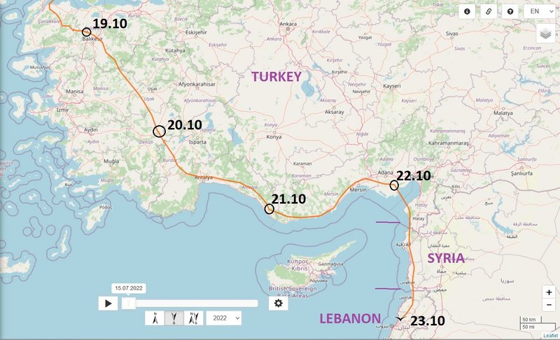
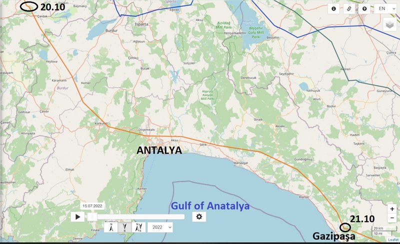
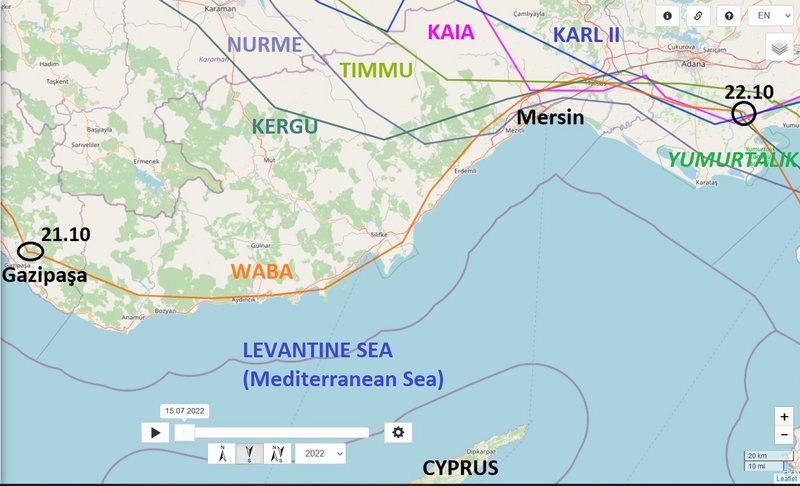
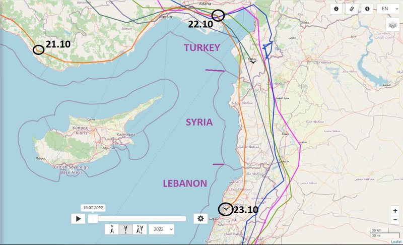
- 20.10.2022 (evening loc.), Distance: 3988 km (+ 157 km) - whole day (20.10): 276 km
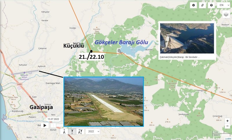
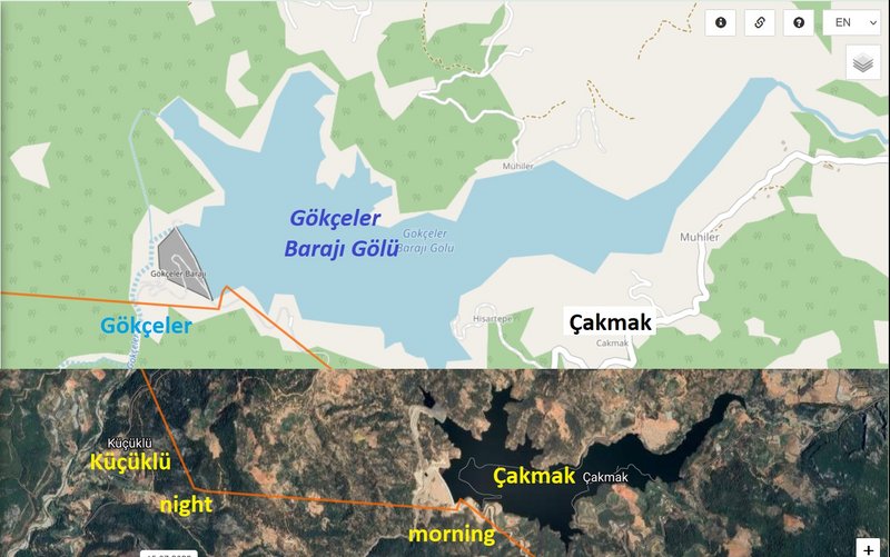
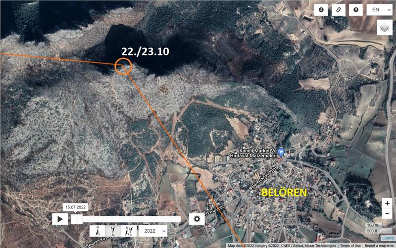
- TURKEY: Baklankuyucak - a village in Bozkurt district of Denizli Province in the Aegean Region
NEW data:
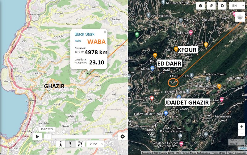
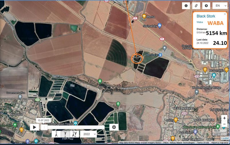
- 23.10.2022 (evening loc.), Distance: 4978 km (+ 990 km in 3 days )
- LEBANON: Jdaidet Ghazir - a village, Kfour municipality in the Keserwan District of Keserwan-Jbeil Governorate
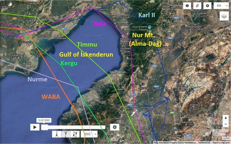
Waba crossed the Gulf of Iskenderun and continued to the south - storklet flew along the Syrian coastline and followed the coastline of Lebanon. Newest localisation is above the forest to the north-west from the village (or SE from the village Ed Dahr).
fingers crossed very, very much - fly safe!
(previous update/data 20.10)
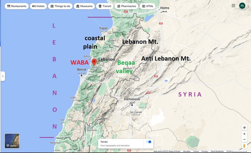
Waba did not fly over the most dangerous areas of Lebanon (the north of Lebanon Mt. and the Beqaa Valley)
(Lebanon from space https://en.wikipedia.org/wiki/Lebanon#/ ... h_2002.jpg - By Jacques Descloitres, MODIS Land Rapid Response Team, NASA/GSFC - Cropped from: http://visibleearth.nasa.gov/view_rec.php?id=2499, Public Domain, https://commons.wikimedia.org/w/index.php?curid=38539)
more Adriána


