KUREMARI, (fe)male

Post Reply
marika.solo
Site Admin
Posts: 11399
Joined: 29 Sep 2021, 09:38

Re: KUREMARI, (fe)male

Post by marika.solo »

previous data Oct 04 viewtopic.php?p=25076#p25076
next data Oct 06 viewtopic.php?p=25137#p25137


October 05
Hello everyone :-)

Birdmap update for KUREMARI
https://birdmap.5dvision.ee/EN/2023/aut ... =0&speed=1

Previous data: viewtopic.php?p=25076#p25076
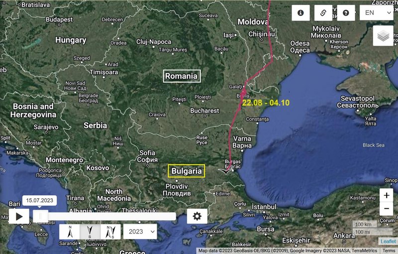
- 04.10.2023, Distance: 2509 km (+ 33 km in 2 days)
- ROMANIA: Giurgeni - a commune, single village, in Ialomița County (Muntenia)

NEW data (first after leaving the stop-over place):
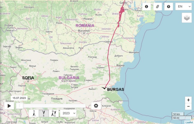
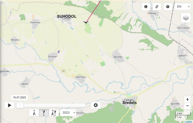
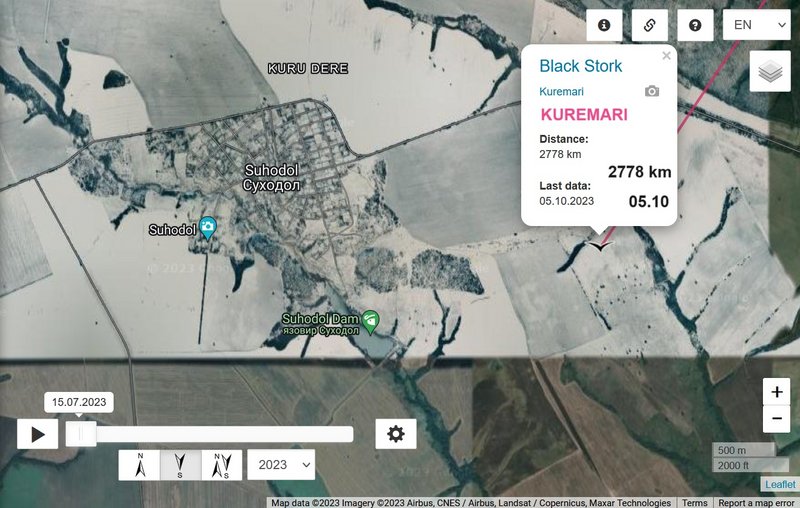
- 05.10.2023, Distance: 2778 km (+ 269 km)
- BULGARIA: Suhodol (Суходол) - a village in Sredets Municipality, in Burgas Province
(southeastern Bulgaria)
marika.solo
Site Admin
Posts: 11399
Joined: 29 Sep 2021, 09:38

Re: KUREMARI, (fe)male

Post by marika.solo »

Image

Image
marika.solo
Site Admin
Posts: 11399
Joined: 29 Sep 2021, 09:38

Re: KUREMARI, (fe)male

Post by marika.solo »

Image

Image
marika.solo
Site Admin
Posts: 11399
Joined: 29 Sep 2021, 09:38

Re: KUREMARI, (fe)male

Post by marika.solo »

previous data Oct 05 viewtopic.php?p=25110#p25110
next data Oct 07 viewtopic.php?p=25153#p25153


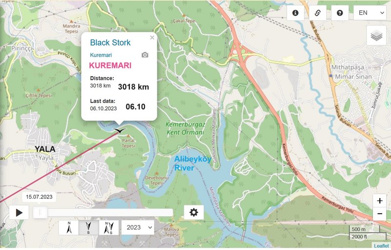
October 06
Hello everyone :-)

Birdmap update for KUREMARI
https://birdmap.5dvision.ee/EN/2023/aut ... =0&speed=1

Previous data (first after leaving the stop-over place):
- 05.10.2023, Distance: 2778 km (+ 269 km)
- BULGARIA: Suhodol (Суходол) - a village in Sredets Municipality, in Burgas Province
(southeastern Bulgaria)

NEW data:
- 06.10.2023, Distance: 3018 km (+ 240 km)
- TURKEY (Europe): Yayla - one of the neighborhoods in the Sultangazi district on the European side of Istanbul
marika.solo
Site Admin
Posts: 11399
Joined: 29 Sep 2021, 09:38

Re: KUREMARI, (fe)male

Post by marika.solo »

Image

Image
marika.solo
Site Admin
Posts: 11399
Joined: 29 Sep 2021, 09:38

Re: KUREMARI, (fe)male

Post by marika.solo »

Image

Image
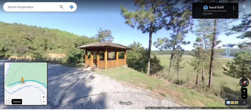
STREET VIEW https://maps.app.goo.gl/3iJAB6Ms9Wp2GRUGA image capture Aug 2020
marika.solo
Site Admin
Posts: 11399
Joined: 29 Sep 2021, 09:38

Re: KUREMARI, (fe)male

Post by marika.solo »

previous data Oct 06 viewtopic.php?p=25137#p25137
next data Oct 09 viewtopic.php?p=25189#p25189


October 07
Hello everyone :-)

Birdmap update for KUREMARI
https://birdmap.5dvision.ee/EN/2023/aut ... =0&speed=1

Previous data:
- 06.10.2023, Distance: 3018 km (+ 240 km)
- TURKEY (Europe): Yayla - one of the neighborhoods in the Sultangazi district on the European side of Istanbul

NEW data:
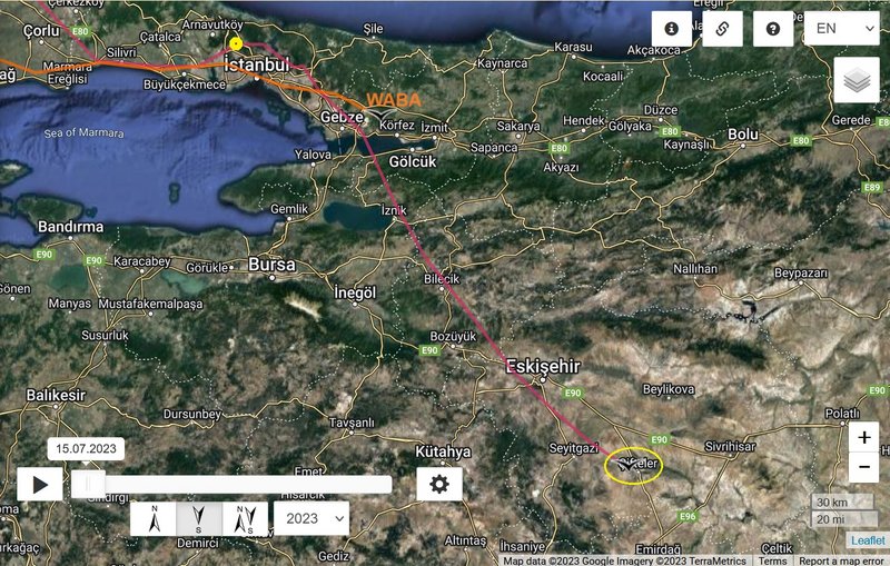
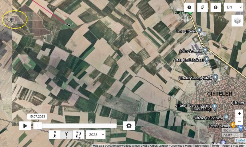
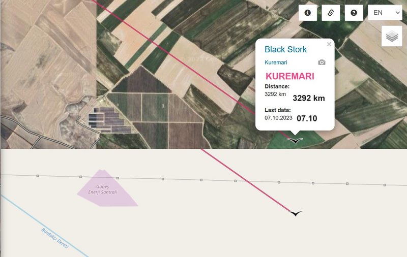
- 07.10.2023, Distance: 3292 km (+ 274 km)
- TURKEY (Asia): Çifteler - a municipality and district of Eskişehir Province

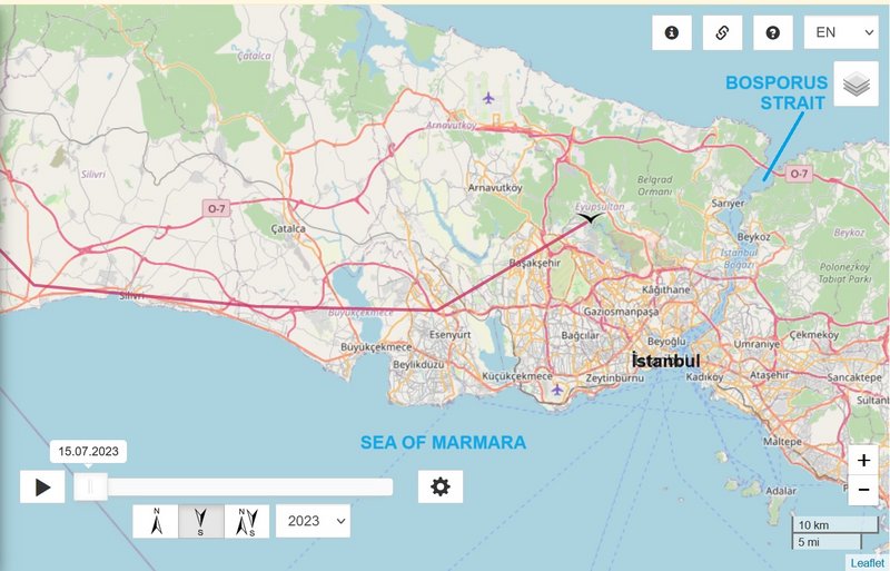
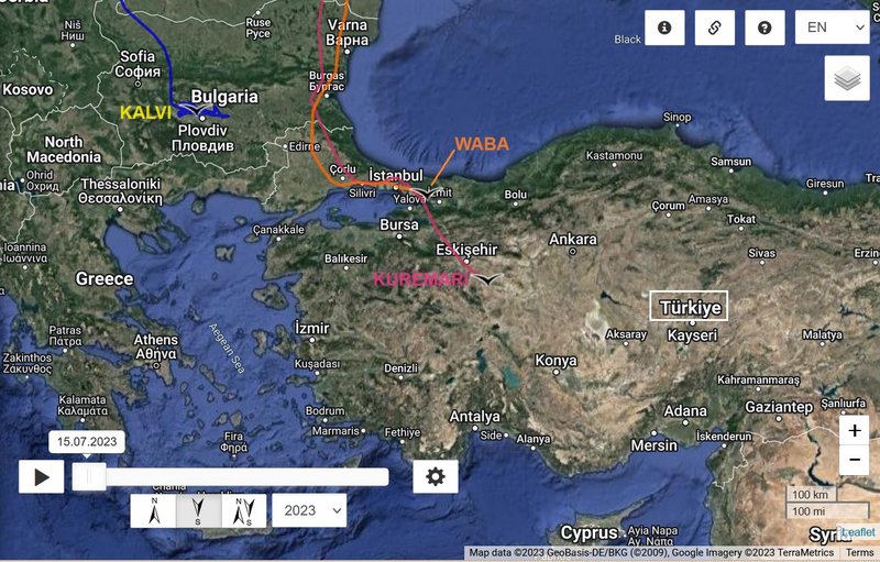
Kuremari flew to Asia via Bosporus Strait/İstanbul in the morning (Waba in the - late - afternoon).

Image

Image
marika.solo
Site Admin
Posts: 11399
Joined: 29 Sep 2021, 09:38

Re: KUREMARI, (fe)male

Post by marika.solo »

Image

Image

there is Kuremari's path line
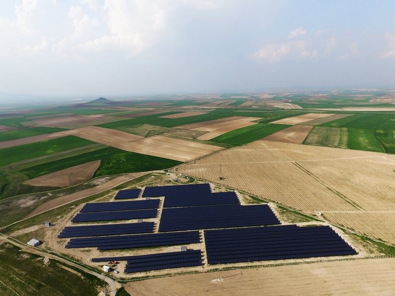
Güneş Enerjisi Santralleri - ÇİFTELER GES PROJESİ (3 MWH) = Solar Power Plants" - ÇİFTELER SPP PROJECT
Image
(source https://www.onpowergroup.com/eskisehir- ... ntralleri/)
marika.solo
Site Admin
Posts: 11399
Joined: 29 Sep 2021, 09:38

Re: KUREMARI, (fe)male

Post by marika.solo »

previous data Oct 07 viewtopic.php?p=25153#p25153
next data Oct 12 viewtopic.php?p=25244#p25244


October 09
Hello everyone :-)

Birdmap update for KUREMARI
https://birdmap.5dvision.ee/EN/2023/aut ... =0&speed=1

Previous data:
- 07.10.2023, Distance: 3292 km (+ 274 km)
- TURKEY (Asia): Çifteler - a municipality and district of Eskişehir Province

NEW data:
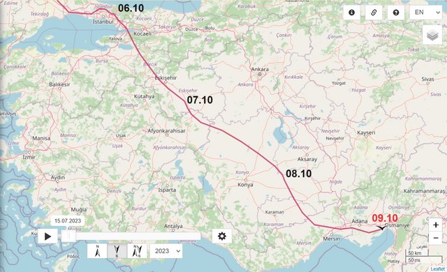
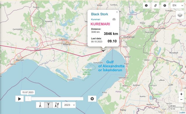
- 09.10.2023, Distance: 3846 km (+ 554 km in 2 days)
- TURKEY: Narlık - a village in the municipality and district of Ceyhan, Adana Province

Kuremari flew direction SE ("stork highway") and arrived to the area of the Gulf of Alexandretta or İskenderun (a gulf of the eastern Mediterranean or Levantine Sea).

Image

Image
marika.solo
Site Admin
Posts: 11399
Joined: 29 Sep 2021, 09:38

Re: KUREMARI, (fe)male

Post by marika.solo »

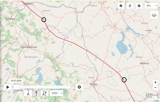
DAY 1 - 08.09.2023

from
TURKEY: Çifteler - a municipality and district of Eskişehir Province
to
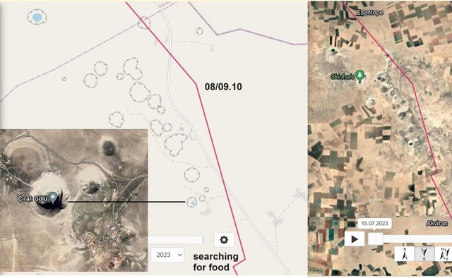
TURKEY: Reşadiye - a village in the Karapınar district of Konya province
localisation is between the villages Reşadiye to the north and Çıralı to the south
Image

Image

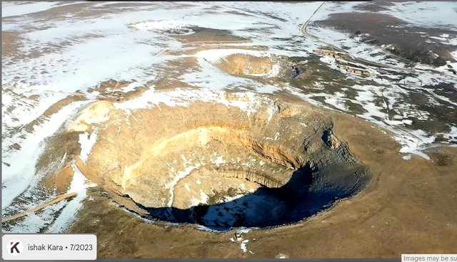
there is interesting area with sinkholes

Giant sinkholes dot the landscape in Turkey's Karapinar - in pictures
Farmers extracting groundwater have caused the water table to drop by two metres
- you can read the reason and see much pictures with description
https://www.thenationalnews.com/mena/gi ... -1.1237751

more morning - done sorry for more than 3 pics

after zooming the map, you can also read the names of these "holes", e.g. Karain Obrugu/Obrugu = Cave
information of these near the village Çıralı - the name the biggest is Çıralı Obrugu:

https://www.obruklular.org.tr/obruk.asp?SiD=2:
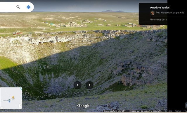
Çıralı Sinkhole is located in the Akviran Plateau in the northwest of Yenikent Sub-district of Konya's Karapınar district.
The edges of this lake within the limestone layer, which is approximately 250 m in diameter, are shaped like a steep bowl with a height of 80 m. The depth of the sinkhole is 125 meters. The depth of the lake in the sinkhole is 35 m. The area where the sinkhole is located is 1077 m high in the north, 1050 m high in the south, and the lake bottom is 953 m high. There are small caves and cavities on steep cliffs around the lake. Like other sinkholes, it is a lake formed in karst terrain, in plains containing limestones and carbonates that can be easily dissolved by water, when deep pits formed by the melting of layers are filled with groundwater or by the collapse of the ceilings of underground caves.
There is an old settlement area from the Roman Period around the lake in the sinkhole. There are settlement ruins and rock tombs from the Roman Period here.

photos on google maps show that the lake is gradually drying up and according to this video it is unfortunately already completely dry :-(
VIDEO (very short - 2 min) https://youtu.be/IQU7DT05IX0?feature=shared uploaded by "KONYA HİKAYELERİ" on 25 Dec 2022
VIDEO (long - 30 min, but we see the wider area too) https://youtu.be/5qdnPW0hiyE?feature=shared uploaded by Ahmet Soyak on 20 Jul 2020

info + photos + video 17.06.2015:
info - https://www.aa.com.tr/tr/kultur-sanat/c ... iyor/35580
photos - htmlhttps://www.konhaber.com/fotogaleri-Cirali_Obru ... r-962.html
video - https://www.aa.com.tr/tr/vg/video-galer ... bekliyor/0
(or here the same https://www.facebook.com/trtturk/videos ... 550951426/)

view on the wider area
Image
https://maps.app.goo.gl/QEt4J7vVdbRNbScR6

maybe the newest photo
Image
https://earth.google.com/web/@37.931662 ... bMO8GAIgAQ
Post Reply

Return to “Latvia”