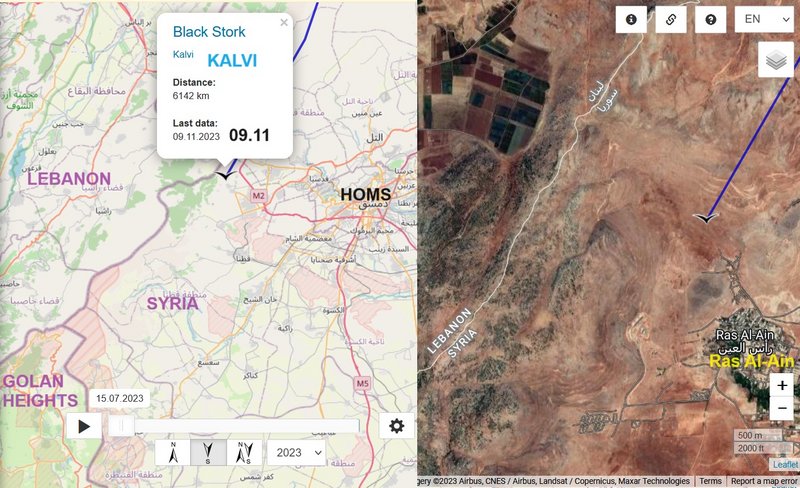
KALVI, hatched 2023

Post Reply
marika.solo
Site Admin
Posts: 11401
Joined: 29 Sep 2021, 09:38

Re: KALVI, hatched 2023

Post by marika.solo »

Image
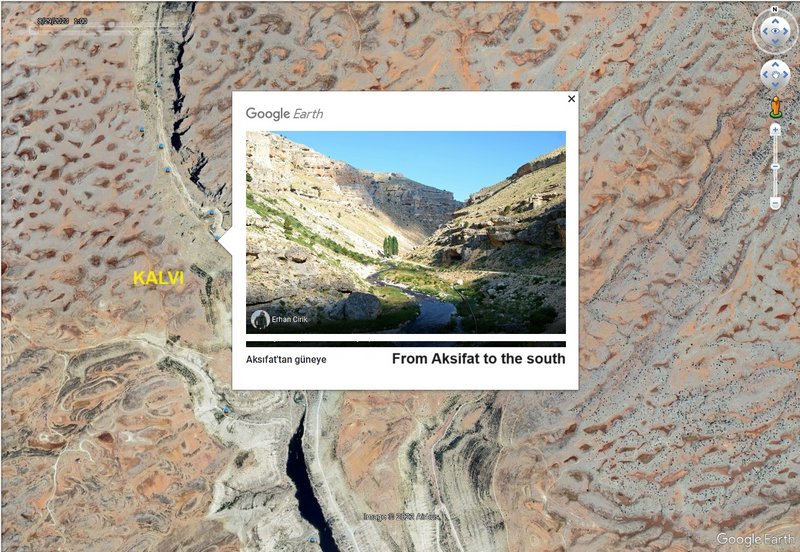
big PHOTO https://lh5.googleusercontent.com/p/AF1 ... liURk=h720 by Erhan Cirik

one of more videos (Aksifat Baraji/Dam - https://www.youtube.com/results?search_ ... FAT+Baraji+)


VIDEO uploaded on 1 Dec 2022 by DSİ 6. Bölge Müdürlüğü

Image
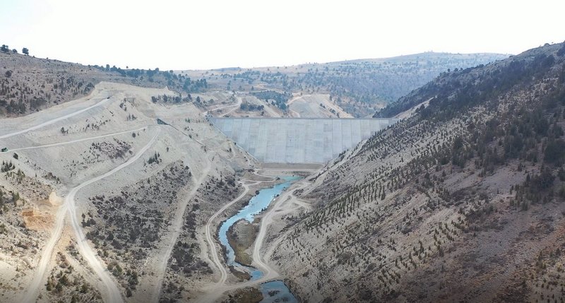
big PHOTO https://cdniys.tarimorman.gov.tr/api/Fi ... raji_2.jpg (source https://bolge06.dsi.gov.tr/Haber/Detay/8007 - 25.11.2022)
marika.solo
Site Admin
Posts: 11401
Joined: 29 Sep 2021, 09:38

Re: KALVI, hatched 2023

Post by marika.solo »

Image
marika.solo
Site Admin
Posts: 11401
Joined: 29 Sep 2021, 09:38

Re: KALVI, hatched 2023

Post by marika.solo »

previous data: Nov 06 viewtopic.php?f=89&t=151&p=25477#p25477
next data: Nov 09 viewtopic.php?f=89&t=151&p=25493#p25493


November 07 data
Hello everyone :-)

Birdmap update for KALVI https://birdmap.5dvision.ee/EN/2023/aut ... =0&speed=1

Previous data:
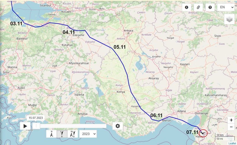
- 06.11.2023, Distance: 4517 km (+ 318 km)
- TURKEY: Sarıaydın - a village in Silifke district of Mersin Province

NEW data:
travelling
- 07.11.2023, Distance: 4776 km (+ 259 km)
- TURKEY: Avsuyu - a village in Antakya district of Hatay Province

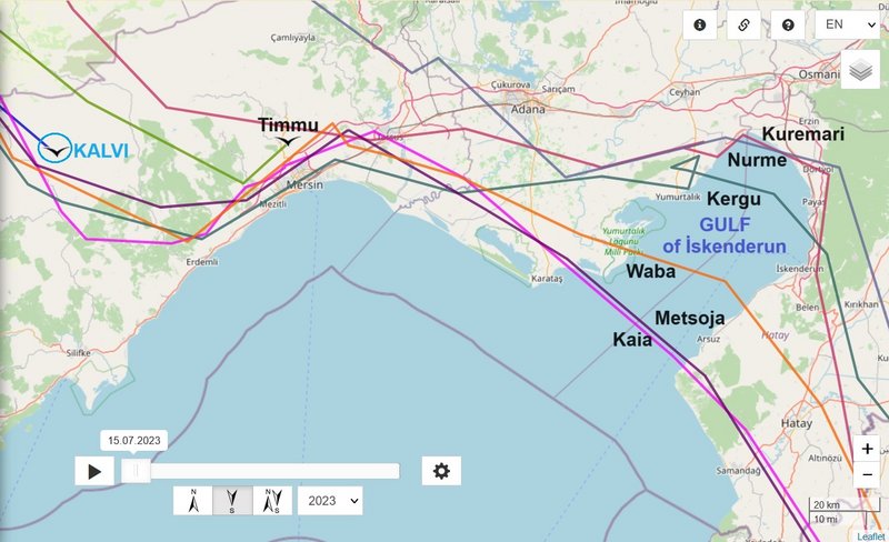
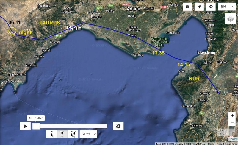
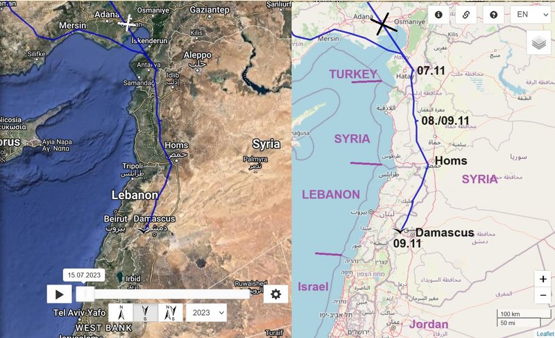
Kalvi crossed today the Gulf of Alexandretta or İskenderun - this gulf is 74 km long, up to 46 km wide and as much as 99 m deep (at the entrance) source: https://encyclopedia2.thefreedictionary.com/Iskenderun

situation
Image

change (today path) - nice wider view on the gulf https://flic.kr/p/2oWfq

Image
marika.solo
Site Admin
Posts: 11401
Joined: 29 Sep 2021, 09:38

Re: KALVI, hatched 2023

Post by marika.solo »

marika.solo
Site Admin
Posts: 11401
Joined: 29 Sep 2021, 09:38

Re: KALVI, hatched 2023

Post by marika.solo »

(I moved the pics from the previous posts)

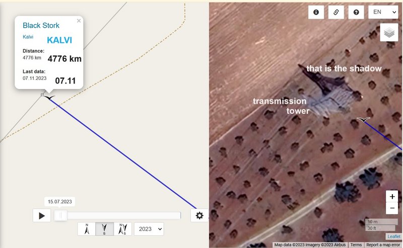
detail - data
Image

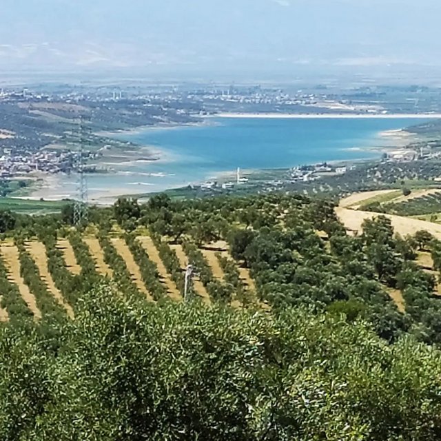
one of the transmission tower there
Image
https://www.facebook.com/1460425147548247/photos/a.3241797816077629/3271862686404475/?type=3&theater&locale=ms_MY
marika.solo
Site Admin
Posts: 11401
Joined: 29 Sep 2021, 09:38

Re: KALVI, hatched 2023

Post by marika.solo »

previous data: Nov 07 viewtopic.php?p=25482#p25482
next data: Nov 10 viewtopic.php?p=25499#p25499


November 09 data
Hello everyone :-)

Birdmap update for KALVI https://birdmap.5dvision.ee/EN/2023/aut ... =0&speed=1
:D

Previous data:
- 07.11.2023, Distance: 4776 km (+ 259 km)
- TURKEY: Avsuyu - a village in Antakya district of Hatay Province

NEW data:
travelling
- 09.11.2023, Distance: 6412 km ! fake line to Ankara Airport)
- SYRIA: Ras al-Ayn - a village in the Qatana District of the Rif Dimashq Governorate

Image

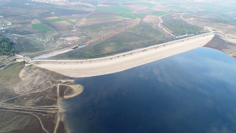
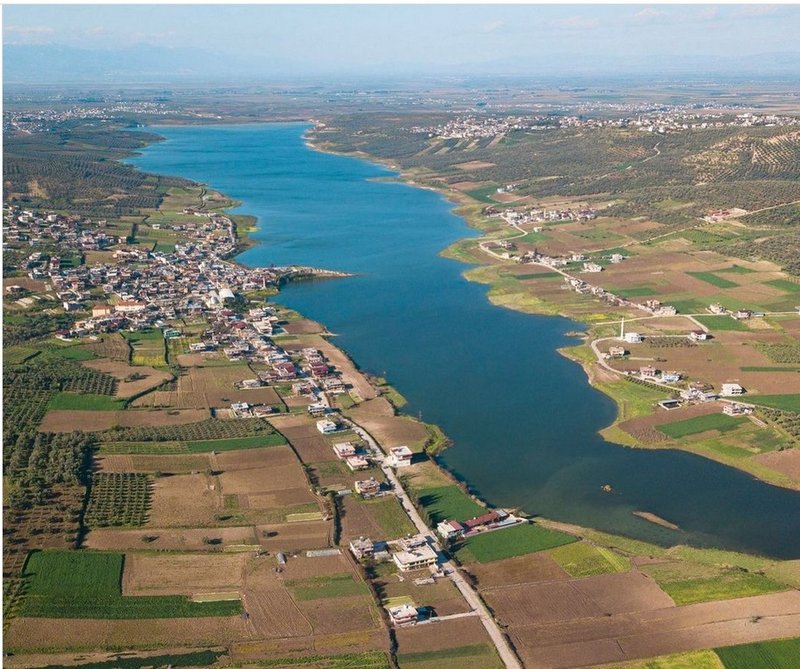
the departure area after last night in Turkey - Altınözü Yarseli Barajı.
Image
(source: https://www.instagram.com/p/CZhUIwJMn8I/ by hataydatrafik)
marika.solo
Site Admin
Posts: 11401
Joined: 29 Sep 2021, 09:38

Re: KALVI, hatched 2023

Post by marika.solo »

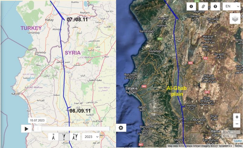
DAY 1 - 08.11

from
TURKEY: Avsuyu - a village in Antakya district of Hatay Province

to
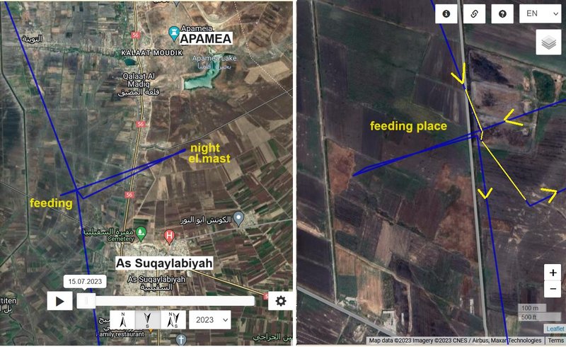
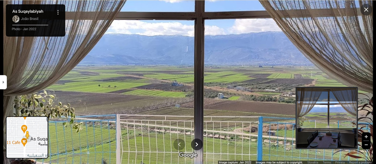
SYRIA: As Suqaylabiyah - a city in Al-Suqaylabiyah District of Hama Governorate

(the district includes most of Al-Ghab plain: https://en.wikipedia.org/wiki/Al-Ghab_Plain - The valley was flooded for centuries by the waters of the Orontes River, which rendered it a swamp. The "Ghab project", beginning in the 1950s, drained the valley to make it habitable, arable land. Before its drainage, the Ghab was the center of the catfish (Silurus glanis) fisheries of the Orontes valley)

description:

Image

not far to the north is the well-known Apamea area (https://en.wikipedia.org/wiki/Apamea,_Syria)
Image

view on the plain (As Suqaylabiyah)
Image
PHOTO https://maps.app.goo.gl/MQ9yW1xptRqPnjwd6 by João Brasil Photo - Jan 2022

(click) wider view on this area (As Suqaylabiyah) https://maps.app.goo.gl/1C7HuJYGEc1PEzdm9 by Muhammad. Khattab Photo - May 2022
marika.solo
Site Admin
Posts: 11401
Joined: 29 Sep 2021, 09:38

Re: KALVI, hatched 2023

Post by marika.solo »

DAY 2 - 09.11

from
SYRIA: As Suqaylabiyah - a city in Al-Suqaylabiyah District of Hama Governorate

to
SYRIA: Ras al-Ayn - a village in the Qatana District of the Rif Dimashq Governorate

description:

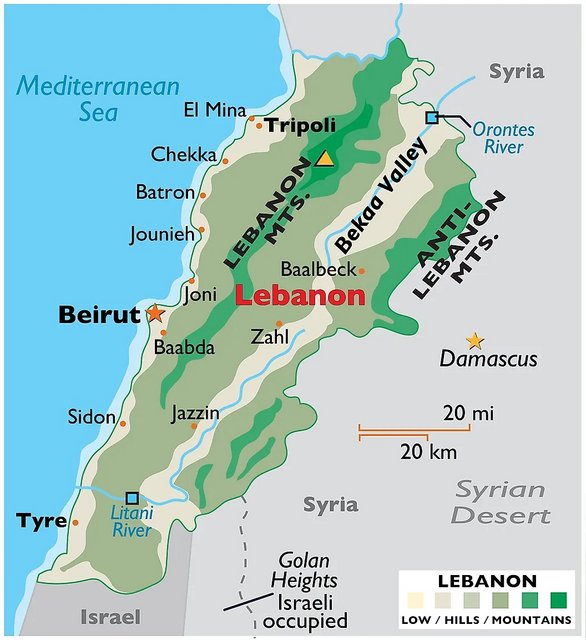
map of the area where Kalvi continued
Image
(source: https://www.worldatlas.com/maps/lebanon)

- Beka Valley https://en.wikipedia.org/wiki/Beqaa_Valley
a fertile valley in eastern Lebanon; the valley is situated between Mount Lebanon to the west and the Anti-Lebanon Mountains to the east

- Anti Lebanon Mt. https://en.wikipedia.org/wiki/Anti-Leba ... #Geography
The Anti-Lebanon range is approximately 150 km in length. To the north, it extends to almost the latitude of the Syrian city of Homs before dying out. To the south, the range coalesces with the Golan Heights plateau but includes the highest peaks of Mount Hermon (Jabalu sh-Shaykh, in Arabic جبل الشيخ), at 2,814 metres and Ta'a Musa at 2,669 metres. These peaks are snow-covered for much of the year and are located on the Israeli-Lebanese-Syrian Border. (source: https://en.advisor.travel/poi/Anti-Leba ... ntains-880)

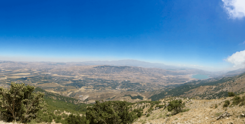
High-up view of the landscape and bright blue sky. The Bekka Valley and the Anti-Lebanon Mountains from Al-Shouf, Lebanon.
© Conservation International/photo by Pierre Carret

Image
big PHOTO https://www.cepf.net/sites/default/file ... ntains.png
(source: https://www.cepf.net/grants/grantee-pro ... an-forests)


maybe we see in the distance the Qattinah Lake (near Homs)
marika.solo
Site Admin
Posts: 11401
Joined: 29 Sep 2021, 09:38

Re: KALVI, hatched 2023

Post by marika.solo »

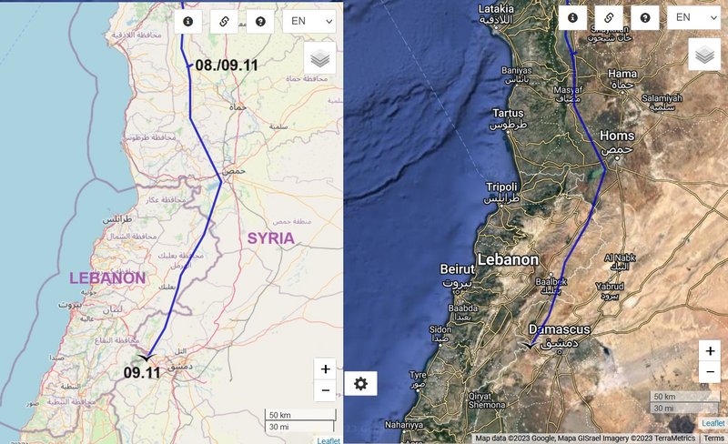
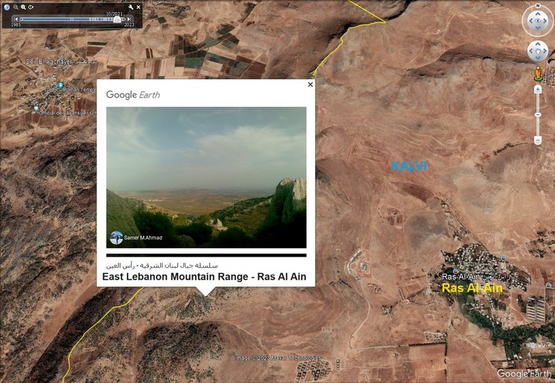
map/s
Image

Image

Anti Lebanon Mountain Range - Ras Al Ain
Image
big PHOTO https://lh5.googleusercontent.com/p/AF1 ... d2v4=h1440 by Samer M.Ahmad
marika.solo
Site Admin
Posts: 11401
Joined: 29 Sep 2021, 09:38

Re: KALVI, hatched 2023

Post by marika.solo »

previous data: Nov 09 viewtopic.php?f=89&t=151&p=25493#p25493
next data: Nov 12 viewtopic.php?p=25516#p25516


November 10 data
Hello everyone :-)

Birdmap update for KALVI https://birdmap.5dvision.ee/EN/2023/aut ... =0&speed=1
:D

Previous data:
- 09.11.2023, Distance: 6412 km ! fake line to Ankara Airport)
- SYRIA: Ras al-Ayn - a village in the Qatana District of the Rif Dimashq Governorate

NEW data:
travelling
- 10.11.2023, Distance: 6468 km (Kalvi flew longer path, more than 300 km)
- ISRAEL: Ein Hatzeva - a moshav , Southern District (it falls under the jurisdiction of Tamar Regional Council)
(to the west of the "village", south-west of the Dead Sea, in the central Arava valley: https://en.wikipedia.org/wiki/Arabah)

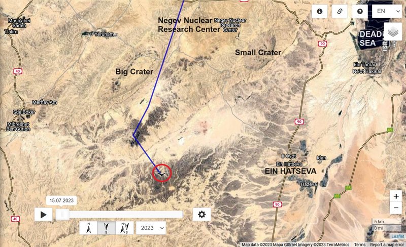
on the map is one long line, only in the end area are more data - Negev desert area
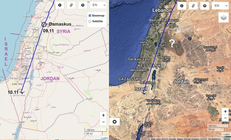
Image

the Big Crater - https://en.wikipedia.org/wiki/HaMakhtesh_HaGadol (also photo)
google search (hamakhtesh hagadol) offers more very nice photos of this area
Image

Image
Post Reply

Return to “Estonia”