WABA (hatched 2022)
Re: WABA (hatched 2022)
previous data: Dec 07 viewtopic.php?p=25795#p25795
next data: Dec 11 viewtopic.php?p=25872#p25872
December 10 data
Hello everyone
Birdmap update for WABA https://birdmap.5dvision.ee/EN/2023/aut ... =0&speed=1
Previous data:
- 07.12.2023, Distance: 11 892 km (+ 105 km in 4 days)
- SUDAN: between Al Mafaza and Munirah - in El Rahad locality of the Al Gedaref/Al Qadarif State
to the north of the Al-Hawwata/El Hawata (one of the bigger localities) and to the east from the Rahad River (Nahr El Rahad)
NEW data:
- 10.12.2023, Distance: 11 900 km (+ 8 km in 3 days)
- SUDAN: between Al Mafaza and Munirah - in El Rahad locality of the Al Gedaref/Al Qadarif State
to the north of the Al-Hawwata/El Hawata (one of the bigger localities) and to the east from the Rahad River (Nahr El Rahad)
Waba is in the same area, with trips to the surrounding area


-
marika.solo
- Site Admin
- Posts: 28024
- Joined: 29 Sep 2021, 09:38
Re: WABA (hatched 2022)
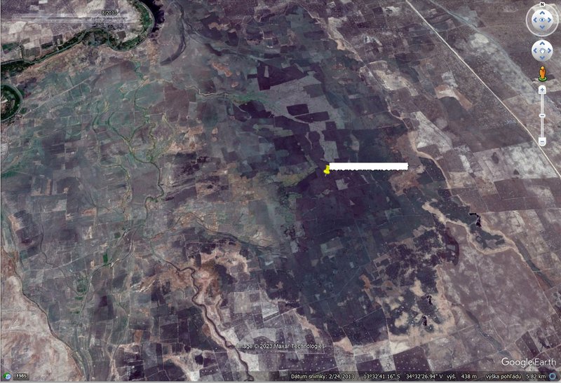
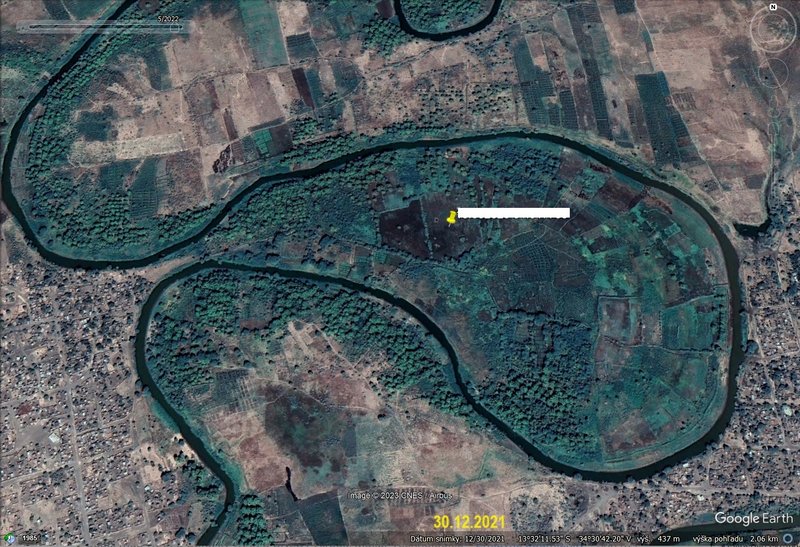
this black/dark view on the birdmap/google map is taken on 23.03.2022 (google earth says)
- some other views: it seems there are fields and some times the area is flooded; if you are interested e.g. there are information - Sudan floods - https://response.reliefweb.int/sudan/floods-2023 (the yellow symbol is the latest GPS location of our Waba)
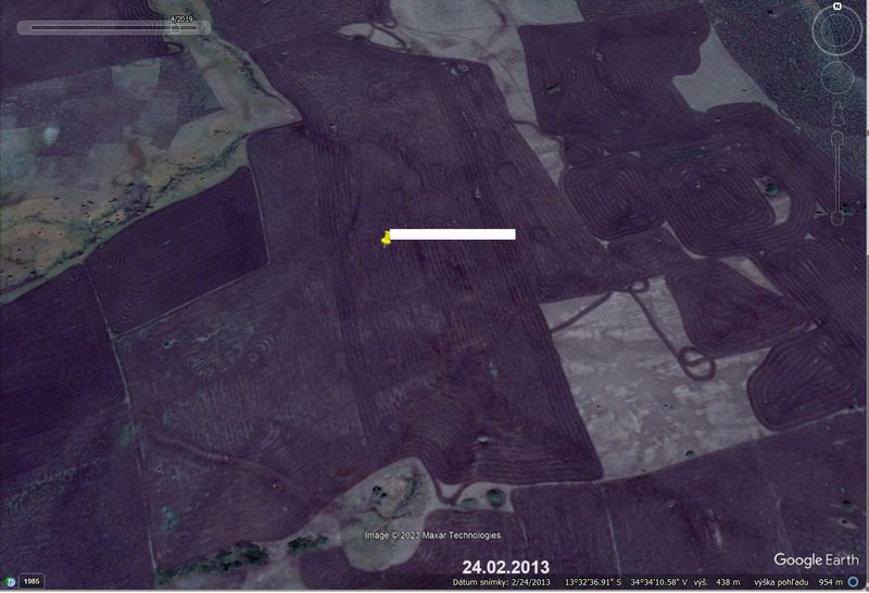
24.02.2013
24.02.2013 detail
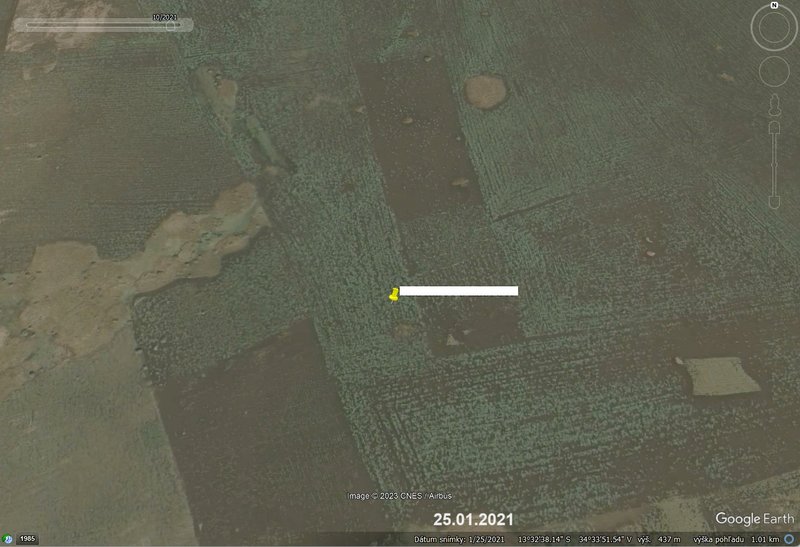
25.01.2021 detail
- some other views: it seems there are fields and some times the area is flooded; if you are interested e.g. there are information - Sudan floods - https://response.reliefweb.int/sudan/floods-2023 (the yellow symbol is the latest GPS location of our Waba)
24.02.2013
24.02.2013 detail
25.01.2021 detail
-
marika.solo
- Site Admin
- Posts: 28024
- Joined: 29 Sep 2021, 09:38
Re: WABA (hatched 2022)
birdmap update
Last data: 11.12.2023 - Distance: 11915 km
new data - same area
more Adriána
Last data: 11.12.2023 - Distance: 11915 km
new data - same area
more Adriána
Re: WABA (hatched 2022)
previous data: Dec 10 viewtopic.php?p=25857#p25857
next data: Dec 12 viewtopic.php?p=25883#p25883
December 11 data
Hello everyone
Birdmap update for WABA https://birdmap.5dvision.ee/EN/2023/aut ... =0&speed=1
Previous data:
- 10.12.2023, Distance: 11 900 km (+ 8 km in 3 days)
- SUDAN: between Al Mafaza and Munirah - in El Rahad locality of the Al Gedaref/Al Qadarif State
to the north of the Al-Hawwata/El Hawata (one of the bigger localities) and to the east from the Rahad River (Nahr El Rahad)
NEW data:
- 11.12.2023, Distance: 11 915 km (+ 15 km)
- SUDAN: between Al Mafaza and Munirah - in El Rahad locality of the Al Gedaref/Al Qadarif State
to the north of the Al-Hawwata/El Hawata (one of the bigger localities) and to the east from the Rahad River (Nahr El Rahad)
Waba is in the same area, with trips to the surrounding area


Re: WABA (hatched 2022)
previous data: Dec 11 viewtopic.php?p=25872#p25872
next data: Dec 17 viewtopic.php?p=25937#p25937
December 12 data
Hello everyone
Birdmap update for WABA https://birdmap.5dvision.ee/EN/2023/aut ... =0&speed=1
Previous data:
- 11.12.2023, Distance: 11 915 km (+ 15 km)
- SUDAN: between Al Mafaza and Munirah - in El Rahad locality of the Al Gedaref/Al Qadarif State
to the north of the Al-Hawwata/El Hawata (one of the bigger localities) and to the east from the Rahad River (Nahr El Rahad)
NEW data:
- 12.12.2023, Distance: 11 927 km (+12 km)
- SUDAN: between Al Mafaza and Munirah - in El Rahad locality of the Al Gedaref/Al Qadarif State
to the north of the Al-Hawwata/El Hawata (one of the bigger localities) and to the east from the Rahad River (Nahr El Rahad)
Waba is in the same area, with trips to the surrounding area


-
marika.solo
- Site Admin
- Posts: 28024
- Joined: 29 Sep 2021, 09:38
Re: WABA (hatched 2022)
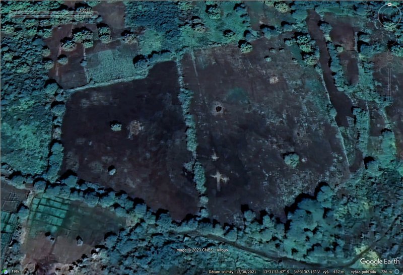
the place visited in the SW - GT says it is Al-Rahad Al-Hawata locality, Ashra village
Waba spent there the entire forenoon
on historical images (google earth), the area is sometimes flooded more and sometimes less (a little) at that time of year
that place in detail
Waba spent there the entire forenoon
on historical images (google earth), the area is sometimes flooded more and sometimes less (a little) at that time of year
that place in detail