GREEN - continuation
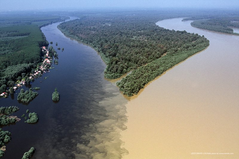
confluence of the Danube and Drava rivers
PHOTO https://www.wwf.eu/?202728/Croatias-acc ... estruction
GREEN is again in the area the Special nature reserve Gornje Podunavlje
PHOTO https://goo.gl/maps/eotGPPUqTPN3LX9C8 image capture Aug 2014
BS with transmitter from nest in RS Makov (to 31.12.2021)
-
- Site Admin
- Posts: 14878
- Joined: 29 Sep 2021, 09:38
-
- Site Admin
- Posts: 14878
- Joined: 29 Sep 2021, 09:38
Re: BS with transmitter from nest in RS Makov
BLUE
(more in the evening - done)
(previos update: viewtopic.php?p=222#p222 and next, the newest localisation viewtopic.php?p=226#p226)
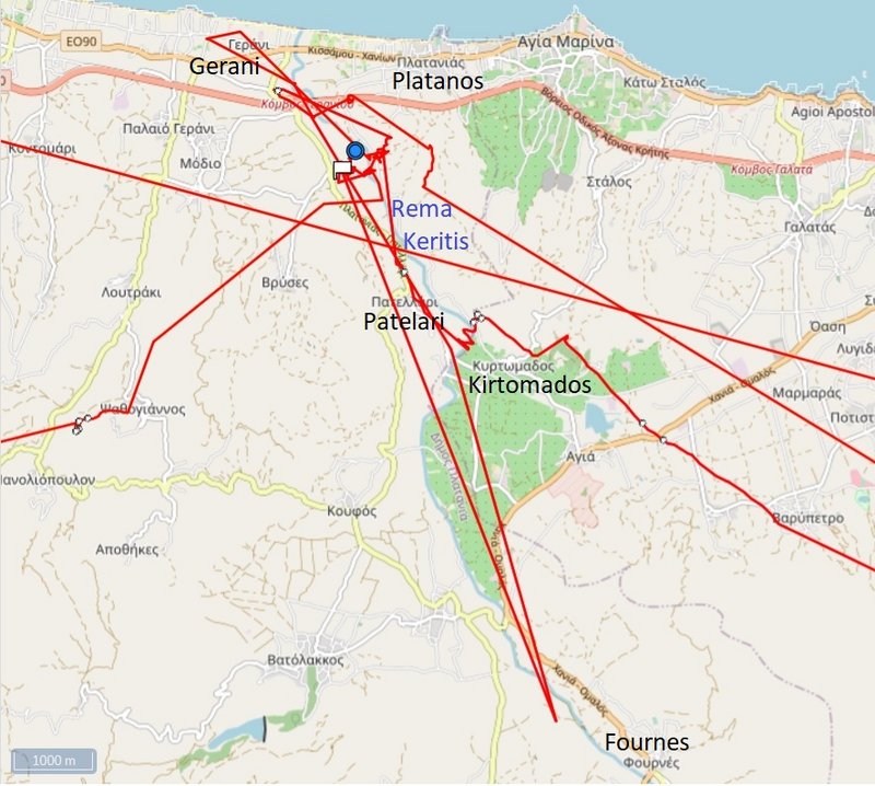
Blue has localisation south- east from Gerani and/or north-east from Vrises (Platanias municipality on the Greek island of Crete - the seat of the municipality is the village Gerani; it lies within the Chania regional unit )
red lines - moving in the last 24 hours
BLUE moved to the (north-)west nearly along the coastline
yesterday we got data at 9.35, stork was already close to the place of yesterday's stay
-
- Site Admin
- Posts: 14878
- Joined: 29 Sep 2021, 09:38
Re: BS with transmitter from nest in RS Makov
BLUE - continuation
at the Interchange (PHOTO: https://i.postimg.cc/FKpBrnbX/2021-10-1 ... st-loc.jpg) BLUE turned and flew south, but almost returned
he spent the whole day around the river and spent the night there
the red symbol is the GPS localisation at midnight
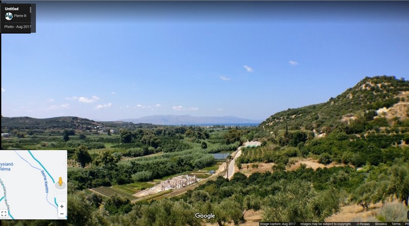
STREET VIEW: no good view to the area - one little better https://goo.gl/maps/a1as35ZYSZ7d6jVY6
PHOTO (view to the valley - to the river https://goo.gl/maps/goQDyuFL7nSFQgSy5 image capture Aug 2017
-
- Site Admin
- Posts: 14878
- Joined: 29 Sep 2021, 09:38
Re: BS with transmitter from nest in RS Makov
October 17
Hello everyone
(more tomorrow - done)
without (big) changes
ORANGE - still no new data
GREEN - in the newest area, it is still the Gornje Podunavlje Special Nature Reserve
BLUE - on the Crete (northern area)
Hello everyone
(more tomorrow - done)
without (big) changes
ORANGE - still no new data
GREEN - in the newest area, it is still the Gornje Podunavlje Special Nature Reserve
BLUE - on the Crete (northern area)
-
- Site Admin
- Posts: 14878
- Joined: 29 Sep 2021, 09:38
Re: BS with transmitter from nest in RS Makov
GREEN public map https://www.makov.cz/clanky/telemetrie-makov-24.html
(previous update viewtopic.php?p=230#p230)
more tomorrow - done
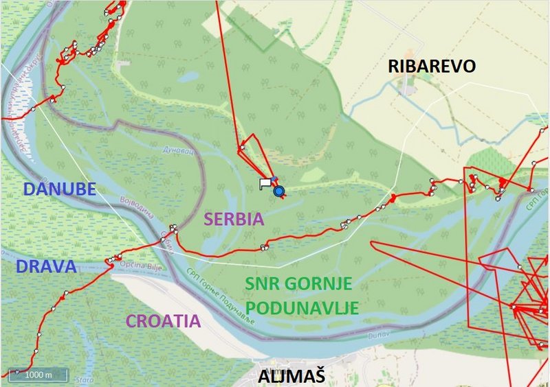
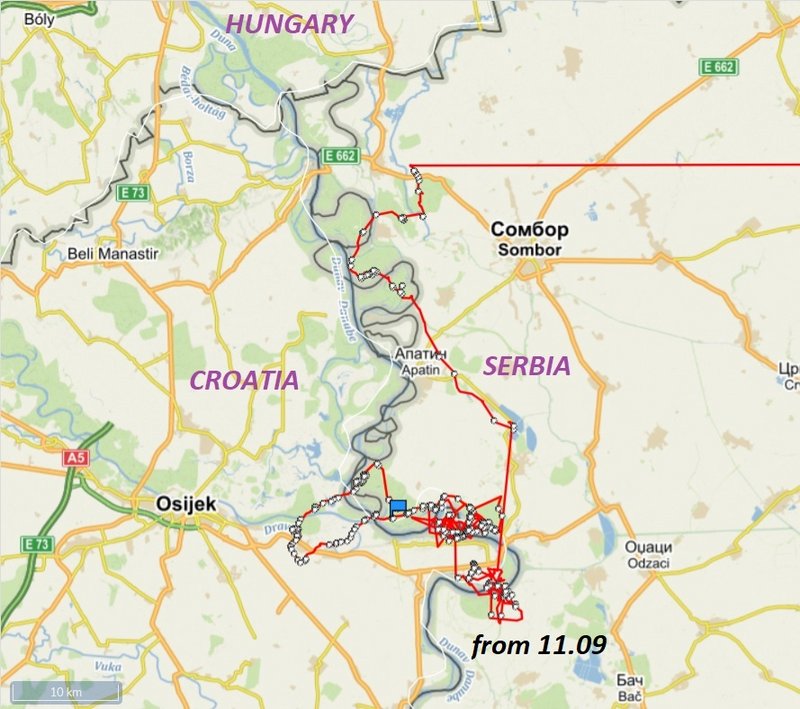
- localisations are east from the confluence Drava - Danube (on the left bank of the Danube), not far to the south from Ribarevo (lodging) - Apatin, Serbia, respectively north from Aljmaš - a village in the Erdut municipality in eastern Croatia (Aljmaš lies on the right bank of the Danube)
the night places in this area
the little pink dots = the EuroVelo 6 in Serbia (this international cycling route follows the meandering Danube)
the blue dot = localisation at midnight 16./17.10 (the white flag = localisation at 5h, 17.10.2021)
stork seems to have found there everything it needs - it moves in a small area
-
- Site Admin
- Posts: 14878
- Joined: 29 Sep 2021, 09:38
Re: BS with transmitter from nest in RS Makov
BLUE public map https://www.makov.cz/clanky/telemetrie-makov-24.html
(previous update viewtopic.php?p=233#p233)
more tomorrow - done
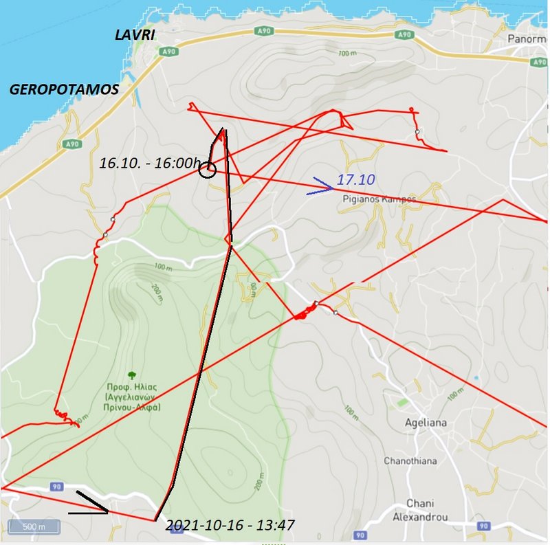
BLUE flew again to the east, followed the coast line, but the data area incomplete
Lavri is one of the beaches of Panormos settlement (to the east); Geropotamos beach is one of the beaches of Prinos settlement (to the west)
(previous update viewtopic.php?p=233#p233)
more tomorrow - done
BLUE flew again to the east, followed the coast line, but the data area incomplete
Lavri is one of the beaches of Panormos settlement (to the east); Geropotamos beach is one of the beaches of Prinos settlement (to the west)
-
- Site Admin
- Posts: 14878
- Joined: 29 Sep 2021, 09:38
Re: BS with transmitter from nest in RS Makov
BLUE - continuation
in Geropotamos the river (with different names on different maps) reach the sea
BLUE spent the time in the valley near this river to the south
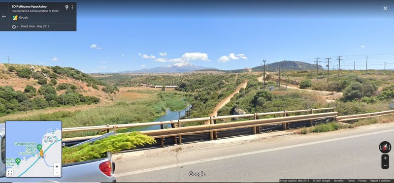
PHOTO
STREET VIEW https://goo.gl/maps/uE3op8SJs6RGm5gw5 image capture May 2019
STREET VIEW: the bridge and the confluence https://goo.gl/maps/rMN56PuagYfftokT6 , Aug 2021 and PHOTO Sep 2021 https://goo.gl/maps/1NgvBNEcTbKAzLha6
STREET VIEW https://goo.gl/maps/yoeX3nkEmDAtZEME8 image capture Oct 2018
-
- Site Admin
- Posts: 14878
- Joined: 29 Sep 2021, 09:38
Re: BS with transmitter from nest in RS Makov
OCTOBER 18
Hello everyone
LAST WEEK
ORANGE still without new data
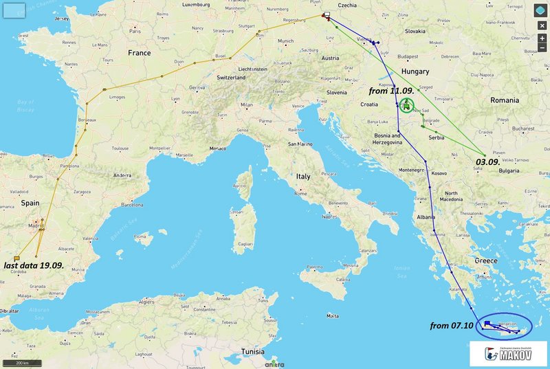
GREEN stayed in the same area - marshlands near Danube; in the area Special Nature Reserve Gornje Podunavlje (the northern area); the last days moved a little to the west
- localisations are east from the confluence Drava - Danube (on the left bank of the Danube), not far to the south from Ribarevo (lodging) - Apatin, Serbia, respectively north from Aljmaš - a village in the Erdut municipality in eastern Croatia (Aljmaš lies on the right bank of the Danube))
BLUE reached Crete on 7.10. and is still there
- stork is exploring Crete
-
- Site Admin
- Posts: 14878
- Joined: 29 Sep 2021, 09:38
Re: BS with transmitter from nest in RS Makov
GREEN - OVERVIEW
GREEN is there in the area Special Nature Reserve Gornje Podunavlje (the northern area)
-
- Site Admin
- Posts: 14878
- Joined: 29 Sep 2021, 09:38
Re: BS with transmitter from nest in RS Makov
GREEN public map https://www.makov.cz/clanky/telemetrie-makov-24.html
(previous update viewtopic.php?p=243#p243 )
- localisations are east from the confluence Drava - Danube (on the left bank of the Danube), not far to the south from Ribarevo (lodging) - Apatin, Serbia, respectively north from Aljmaš - a village in the Erdut municipality in eastern Croatia (Aljmaš lies on the right bank of the Danube)