Kuremari, young female (data on the birdmap)

Post Reply
marika.solo
Site Admin
Posts: 17986
Joined: 29 Sep 2021, 09:38

Re: Kuremari, young female (data on the birdmap)

Post by marika.solo »

August 23

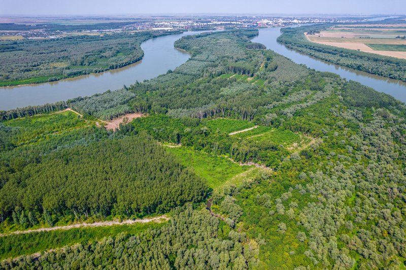
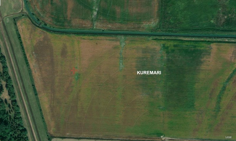
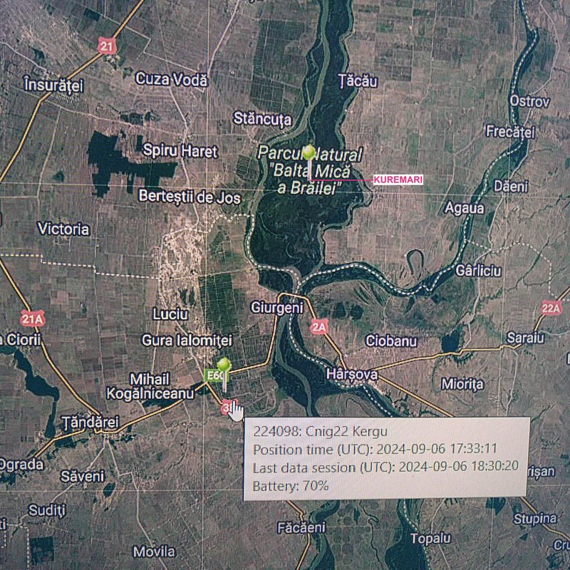
Kuremari is still on the same island (Fundu Mare) and is moving within the lake Chiriloaia (to the north) and Misaila (to the south)
(info + pics already here: https://www.ciconianigra.sk/viewtopic.p ... 533#p39533)

Image
source: https://restore4life.eu/monitoring-site ... d-romania/

2023 season - info, photo https://www.ciconianigra.sk/viewtopic.p ... 811#p24811

August 24

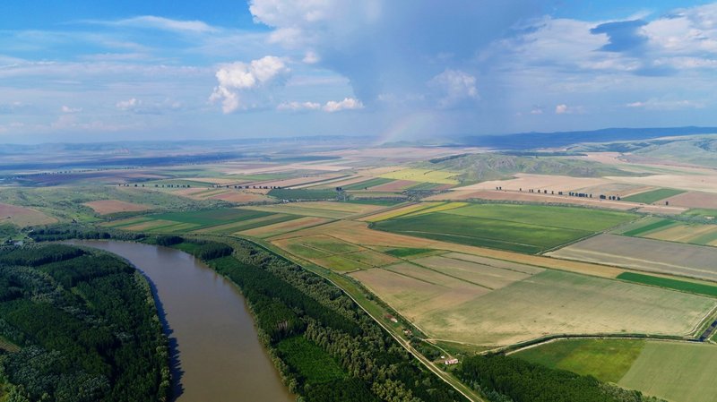
Kuremari moved to the next island - Lupu / Lupului (Calia sau Caleia)
(map of the islands is here https://www.ciconianigra.sk/viewtopic.p ... 534#p39534)
marika.solo
Site Admin
Posts: 17986
Joined: 29 Sep 2021, 09:38

Re: Kuremari, young female (data on the birdmap)

Post by marika.solo »

August 25

Kuremari stayed this day on the Lupu Island, but again visited the fields to the east from the village Tichilești

August 26

Kuremari spent the whole day on the Lupu Island
marika.solo
Site Admin
Posts: 17986
Joined: 29 Sep 2021, 09:38

Re: Kuremari, young female (data on the birdmap)

Post by marika.solo »

August 27

Kuremari moved to the east from the Lupu Island to the bank of the Danube river (on the Great Brăila Island).

August 28

After night on the island Lupu the day Kuremari spent the day and night on the fields (melioration canals) of the Great Brăila Island

view on one of the islands
Image
pic from VIDEO https://youtu.be/2c8pv2dXuco?si=fBzz51lYHktk0m0f

info:
marika.solo
Site Admin
Posts: 17986
Joined: 29 Sep 2021, 09:38

Re: Kuremari, young female (data on the birdmap)

Post by marika.solo »

August 29

Kuremari moved around midday again to the south on the Small Island of Brăila (Insula Mică a Brăilei)
(map of the islands is here https://www.ciconianigra.sk/viewtopic.p ... 534#p39534)

August 30

Kuremari explored this new place (to the east is the Valciu Arm)
marika.solo
Site Admin
Posts: 17986
Joined: 29 Sep 2021, 09:38

Re: Kuremari, young female (data on the birdmap)

Post by marika.solo »

August 31

Kuremari spent the time on the island and to the east on the Great Brăila Island on the Danube river (the two river branches which separate it from the mainland are Măcin Branch and Vâlciu Branch)

"Braila Islands site has a total surface of over 2600 km2. This socio-ecological system is inhabited by near 300,000 people and comprises heavily modified ecosystems (e.g. Big Island of Braila, former wetland transformed into agricultural land, with an area of about 2300 km2) but also systems under a natural functional regime (e.g. Small Islands of Braila), being of a crucial natural and socio-economical value. The Danube river along the Braila Islands section has been ranked as a heavily modified water body according to criteria 2.1 (embankment works) due to the hydro-technical works on more than 79% of the river stretch sector and a candidate to “heavily modified” according with the WFD criteria 2.2 (regulation works) as a result of dredging of 21% of the river bed for intensive navigation. The main remnant of the natural floodplains consists in the wetlands from the Small Island of Braila Natural Park with a total surface of 210 km2 and the floodplains between the riverbanks and dikes of almost 93 km2."
(https://restore4life.eu/monitoring-site ... d-romania/)

illustration - Big/Great Braila Island and the banks of the Danube
Image
PHOTO https://assets.wam.ae/uploads/2018/09/1039560958644.jpg
source https://wam.ae/en/details/1395302709825
marika.solo
Site Admin
Posts: 17986
Joined: 29 Sep 2021, 09:38

Re: Kuremari, young female (data on the birdmap)

Post by marika.solo »

September 01

September 02
Kuremari is still in the same area

Revolutionary Irrigation Project on the Great Island of Brăila, Romania


uploaded on 27.08.2024 by Valley Irrigation

The Great Brăila Island (Romanian: Insula Mare a Brăilei) is an island on the Danube river in the Brăila County, Romania. It has on average 57.9 km length and 18.6 km width, with a total area of 710 km². The two river branches which separate it from the mainland are Măcin Branch and Vâlciu Branch.
marika.solo
Site Admin
Posts: 17986
Joined: 29 Sep 2021, 09:38

Re: Kuremari, young female (data on the birdmap)

Post by marika.solo »

September 03

nothing new - Kuremari is still in the same area, moved little to the south

September 04

- Kuremari is still in the same area, but this day she spent on the Big Island (irrigated field)
- all localisations are on one very little place ( :? )

Image

illustration
Image
PHOTO https://restore4life.eu/wp-content/uplo ... scaled.jpg (source: https://restore4life.eu/monitoring-site ... d-romania/)
marika.solo
Site Admin
Posts: 17986
Joined: 29 Sep 2021, 09:38

Re: Kuremari, young female (data on the birdmap)

Post by marika.solo »

Islands of Braila Ecological Complex

A—Big Island (polder), B—Small Islands of Braila/SIBr (wetland system), C—Floodplain between river bank and dikes (narrow strip), D—Lateral floodplains (polder)
(polder: a piece of low-lying land reclaimed from the sea or a river and protected by dikes)

- 45 % of the SIBr consist in shallow and very shallow lakes, bogs, deep channels and river arms
- 15 % of the area is flooded for 6–7 months per year and that are mainly reed and rush marshes and
- 40 % of the land is flooded for 2–3 months per year. The short term flooded areas comprise: alluvial forests, riparian galleries and tickets, halophytic shrub associations, poplar plantations and grasslands (data 2003 !)

(source: Vadineanu, Angheluta & Adamescu, Cristian & Vadineanu, Radu & Cristofor, Sergiu & Negrei, Costel. (2003). Past and Future Management of Lower Danube Wetlands System: A Bioeconomic Appraisal. Journal of Interdisciplinary Economics. 14. 415-447. 10.1177/02601079X03001400407. )
marika.solo
Site Admin
Posts: 17986
Joined: 29 Sep 2021, 09:38

Re: Kuremari, young female (data on the birdmap)

Post by marika.solo »

September 05

Kuremari spent the whole day in the area of the Small Islands of Braila - in the northern part of the main island: Mică a Brăilei /Small Island (to the east from the island Crăcănel or Chiciu - NW and Vărsătura - SW). She is moving in the area of the Parcul Natural "Balta Mică a Brăila (PN-BmB) / Balta Mică a Brăila Natural Park.

edit:
The Small Island of Brăila is part of the Balta Mică Natural Park, nicknamed the "second Delta" of the country. In addition to this, it was also registered in Natura 2000 Site and Ramsar Site.
It is one of the most representative destinations of the county, being among the visitors' favourites. Although Balta Brăilei has a total of seven islands, it is also the most important from a scientific point of view, due to its Delta-like ecosystem.
(https://planiada.ro/destinatii/braila/i ... railei-386)

Image

Image
(source: http://bmb.ro/files/dcc/swot.pdf - Map of the 15 tourist routes identified in Small Wetland of Braila)
marika.solo
Site Admin
Posts: 17986
Joined: 29 Sep 2021, 09:38

Re: Kuremari, young female (data on the birdmap)

Post by marika.solo »

September 06
Hello everyone :-)

"data source" : our Madli :D

Kuremari and Kergu
They are about 15-20 km from each other in Romania.


Previous data:
- 16.08.2024 (at 16.38)
- MOLDOVA: Lipovanca - a village (Bilicenii Noi commune) in Sîngerei District

NEW data:
- 06.09.2024 (?)
- Romania: Small Island of Braila /Insula Mică a Brăilei (to the east from the island Crăcănel or Chiciu - NW and Vărsătura - SW).
She is moving in the area of the Parcul Natural "Balta Mică a Brăila (PN-BmB) / Balta Mică a Brăila Natural Park.

- more videos (youtube) search for "Insula Mică a Brăilei"
- next info: https://www.birdingplaces.eu/en/birding ... -a-brailei (Top 5 birds: 2. Black Stork)

Image
Post Reply

Return to “Latvia”