WABA (2022)
-
marika.solo
- Site Admin
- Posts: 28024
- Joined: 29 Sep 2021, 09:38
Re: WABA (2022)
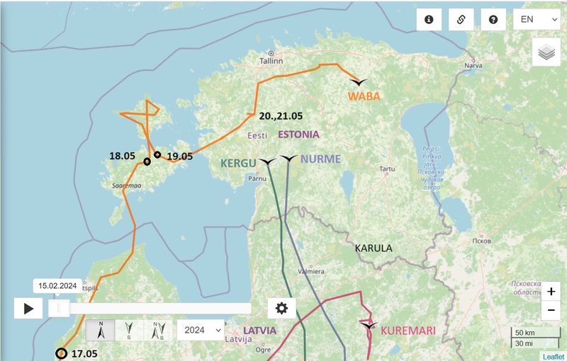
April 16 data
Hello everyone
Previous data
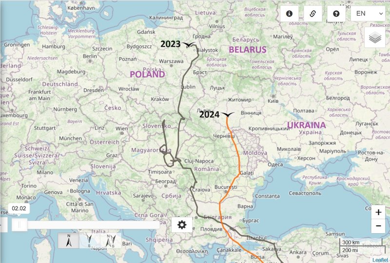
- 15.05.2024, Distance: 6610 km (+ 644 km in 2 days)
- UKRAINA: Volytsya/Волиця - a village in Chortkiv Raion (previous Husiatyn) of Ternopil Oblast (western Ukraine)
NEW data
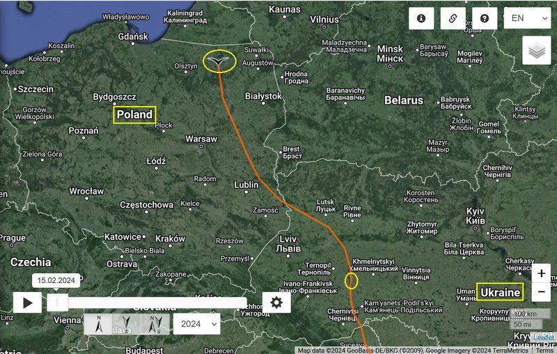
- 16.05.2024, Distance: 7256 km (+ 646 km)
- POLAND: Dzikowizna - a settlement in Gmina/district Korsze, within Kętrzyn County, Warmian-Masurian Voivodeship (northern Poland)
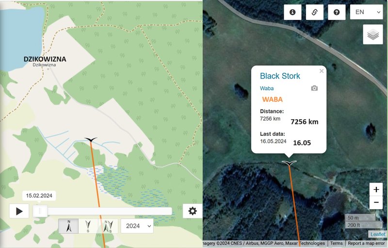
the nearby area - Jezioro/Lake Orło PHOTO https://maps.app.goo.gl/YAZp267atbGsXSmp9 by Jerzy Dudziński Photo - Jul 2012
Hello everyone
Previous data
- 15.05.2024, Distance: 6610 km (+ 644 km in 2 days)
- UKRAINA: Volytsya/Волиця - a village in Chortkiv Raion (previous Husiatyn) of Ternopil Oblast (western Ukraine)
NEW data
- 16.05.2024, Distance: 7256 km (+ 646 km)
- POLAND: Dzikowizna - a settlement in Gmina/district Korsze, within Kętrzyn County, Warmian-Masurian Voivodeship (northern Poland)
the nearby area - Jezioro/Lake Orło PHOTO https://maps.app.goo.gl/YAZp267atbGsXSmp9 by Jerzy Dudziński Photo - Jul 2012
-
marika.solo
- Site Admin
- Posts: 28024
- Joined: 29 Sep 2021, 09:38
Re: WABA (2022)
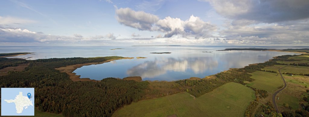
A lake with an area of 1.15 km². There are two villages by the lake: Orło and Głąbowo and the settlement of Dzikowizna.
Orło Lake and its surroundings
video uploaded on 25 Aug 2021 by Ryniacz
Orło Lake and its surroundings
video uploaded on 25 Aug 2021 by Ryniacz
-
marika.solo
- Site Admin
- Posts: 28024
- Joined: 29 Sep 2021, 09:38
Re: WABA (2022)
April 17 data
Hello everyone
Previous data
- 16.05.2024, Distance: 7256 km (+ 646 km)
- POLAND: Dzikowizna - a settlement in Gmina/district Korsze, within Kętrzyn County, Warmian-Masurian Voivodeship (northern Poland)
NEW data
- 17.05.2024, Distance: 7569 km (+ 313 km)
- LATVIA: Vērgale (historically also Vērgaļi) - a village in Vērgale Parish of Southern Kurzeme region
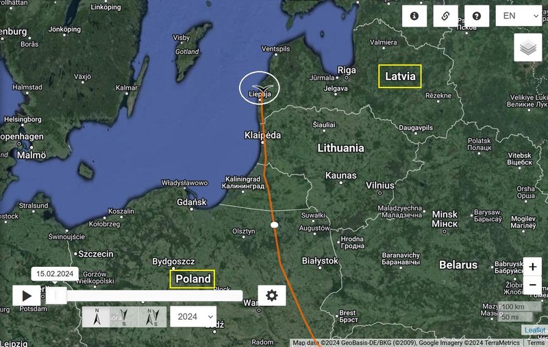
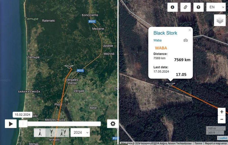
STREET VIEW - somewhere in the distance is the newest localisation/night roost of our Waba
https://maps.app.goo.gl/6oBWpdUBufVupesQ9 Google Street View Jun 2023
Hello everyone
Previous data
- 16.05.2024, Distance: 7256 km (+ 646 km)
- POLAND: Dzikowizna - a settlement in Gmina/district Korsze, within Kętrzyn County, Warmian-Masurian Voivodeship (northern Poland)
NEW data
- 17.05.2024, Distance: 7569 km (+ 313 km)
- LATVIA: Vērgale (historically also Vērgaļi) - a village in Vērgale Parish of Southern Kurzeme region
STREET VIEW - somewhere in the distance is the newest localisation/night roost of our Waba
https://maps.app.goo.gl/6oBWpdUBufVupesQ9 Google Street View Jun 2023
-
marika.solo
- Site Admin
- Posts: 28024
- Joined: 29 Sep 2021, 09:38
Re: WABA (2022)
May 18
Hello everyone
Previous data
- 17.05.2024, Distance: 7569 km (+ 313 km)
- LATVIA: Vērgale (historically also Vērgaļi) - a village in Vērgale Parish of Southern Kurzeme region
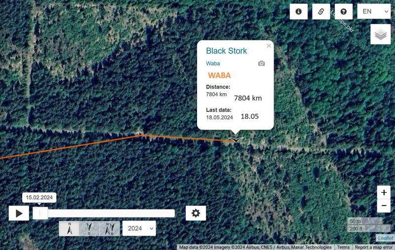
NEW data
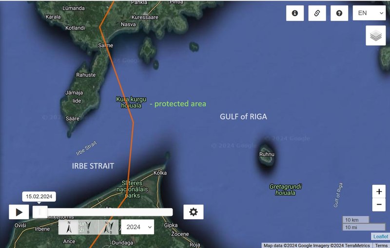
- 18.05.2024, Distance: 7804 km (+ 235 km)
- ESTONIA: Luulupe - a village in Saaremaa Parish, Saare County (western Estonia)
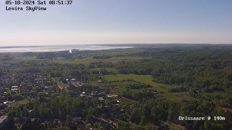
btw. Udu (hatched 2021 in Karula nest) flew similar path but in opposite direction (first migration - birdmap info: "Udu used migration path we did not know before, first two days west, then two days north and then south-west over Saaremaa Island to Latvia." https://postimg.cc/Y49GVSf4)
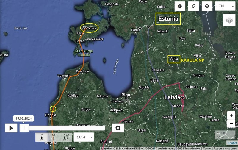
cca 40 min. above the open water
Hello everyone
Previous data
- 17.05.2024, Distance: 7569 km (+ 313 km)
- LATVIA: Vērgale (historically also Vērgaļi) - a village in Vērgale Parish of Southern Kurzeme region
NEW data
- 18.05.2024, Distance: 7804 km (+ 235 km)
- ESTONIA: Luulupe - a village in Saaremaa Parish, Saare County (western Estonia)
btw. Udu (hatched 2021 in Karula nest) flew similar path but in opposite direction (first migration - birdmap info: "Udu used migration path we did not know before, first two days west, then two days north and then south-west over Saaremaa Island to Latvia." https://postimg.cc/Y49GVSf4)
cca 40 min. above the open water
-
marika.solo
- Site Admin
- Posts: 28024
- Joined: 29 Sep 2021, 09:38
Re: WABA (2022)
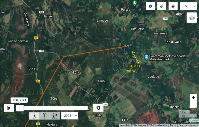
STREET VIEW https://maps.app.goo.gl/dBsnUWSKRT9wqQMb7 Luulupe, Saare County Google Street View Jul 2011
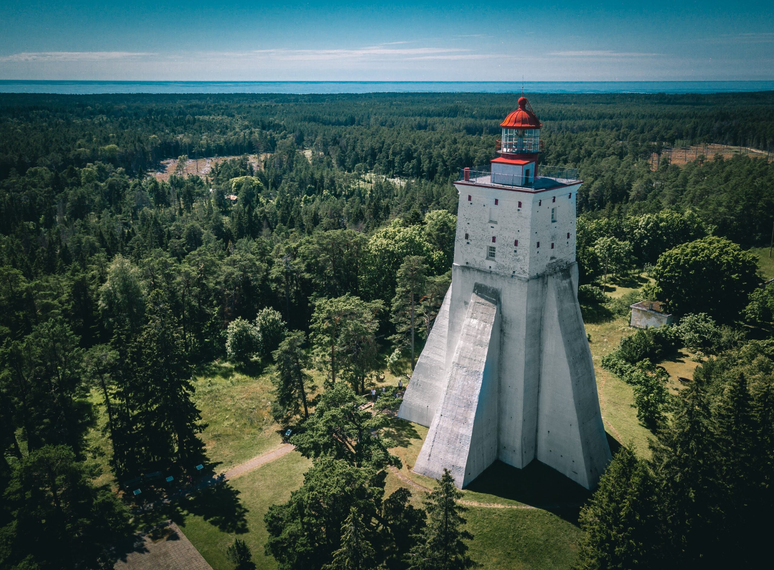
short video Discover SAAREMAA, Estonia
uploaded on 5 Apr 2022 by JayWay Travel
one of views on the island
(some information https://estonianworld.com/life/saaremaa ... ds-europe/ ; https://en.wikipedia.org/wiki/Saaremaa ; https://visitsaaremaa.ee/en/ ; https://www.visitestonia.com/en/saaremaa
(source - camera https://www.outdooractive.com/en/webcam ... 803714707/)
-
marika.solo
- Site Admin
- Posts: 28024
- Joined: 29 Sep 2021, 09:38
Re: WABA (2022)
May 19 data
Hello everyone
Previous data
- 18.05.2024, Distance: 7804 km (+ 235 km)
- ESTONIA: Luulupe - a village in Saaremaa Parish, Saare County (western Estonia)
situation - change (from one island to another one)
NEW data
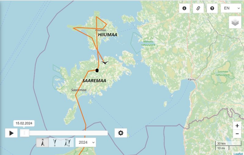
- 19.05.2024, Distance: 7982 km (+ 178 km)
- ESTONIA: Roobaka - a village in Saaremaa Parish, Saare County (western Estonia)
HIIUMIA https://en.wikipedia.org/wiki/Hiiumaa ... "The bird species found on the island include black storks, golden eagles, cranes, avocets and swans."
https://hiiumaa.ee/en/about-hiiumaa/
https://baltictrails.eu/en/coastal/rout ... 2/worthsee
situation - change (from one island to another one above the Soela Strait)
STREET VIEW https://maps.app.goo.gl/6qbnExDwsTAJDngu9 Võlupe-Pärsama Roobaka, Saare County Google Street View Jul 2011
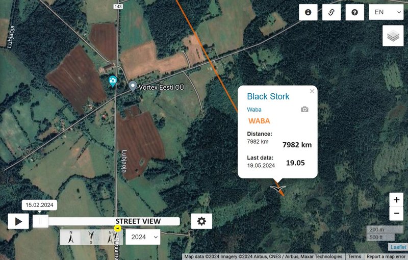
STREET VIEW to his newest localisation - night roost
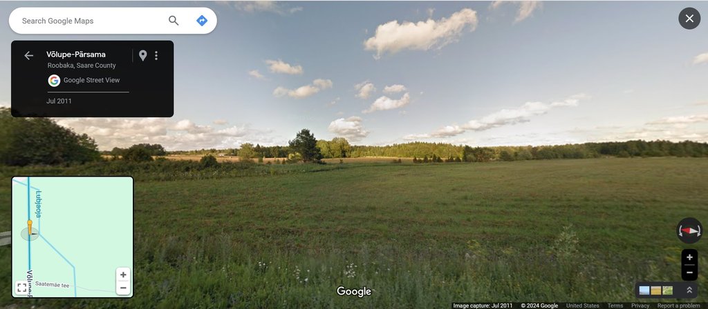
https://maps.app.goo.gl/hnbMhgxUJwcTD8dP9 Võlupe-Pärsama Roobaka, Saare County Google Street View Jul 2011
Hello everyone
Previous data
- 18.05.2024, Distance: 7804 km (+ 235 km)
- ESTONIA: Luulupe - a village in Saaremaa Parish, Saare County (western Estonia)
situation - change (from one island to another one)
NEW data
- 19.05.2024, Distance: 7982 km (+ 178 km)
- ESTONIA: Roobaka - a village in Saaremaa Parish, Saare County (western Estonia)
HIIUMIA https://en.wikipedia.org/wiki/Hiiumaa ... "The bird species found on the island include black storks, golden eagles, cranes, avocets and swans."
https://hiiumaa.ee/en/about-hiiumaa/
https://baltictrails.eu/en/coastal/rout ... 2/worthsee
situation - change (from one island to another one above the Soela Strait)
STREET VIEW https://maps.app.goo.gl/6qbnExDwsTAJDngu9 Võlupe-Pärsama Roobaka, Saare County Google Street View Jul 2011
STREET VIEW to his newest localisation - night roost
https://maps.app.goo.gl/hnbMhgxUJwcTD8dP9 Võlupe-Pärsama Roobaka, Saare County Google Street View Jul 2011
-
marika.solo
- Site Admin
- Posts: 28024
- Joined: 29 Sep 2021, 09:38
Re: WABA (2022)
by Andres r uploaded on 3 Jul 2020
https://youtu.be/DzCj1baCR2E?si=FTIAYmPauRKo7uND
or one long(er) https://youtu.be/nyWbkxISlV0?si=GqtK7TUdgUZ_fgFP
Coast of Hiiumaa
File:Hellamaa panoraam.jpg Created: 28 September 2013 by Hiiumaamudeliklubi
(By Hiiumaamudeliklubi - Own work, CC BY-SA 3.0, https://commons.wikimedia.org/w/index.p ... d=29389615)
https://visitsaaremaa.ee/mosaaremaa/en/ ... m-hiiumaa/
-
marika.solo
- Site Admin
- Posts: 28024
- Joined: 29 Sep 2021, 09:38
Re: WABA (2022)
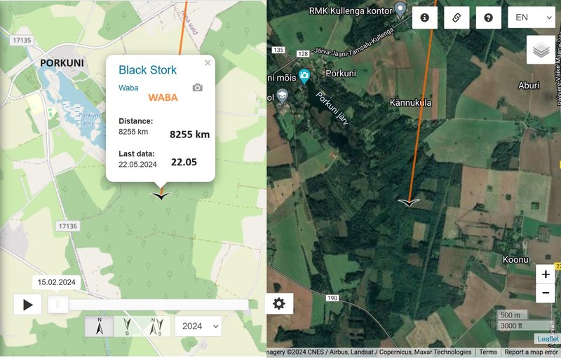
May 22 data
Hello everyone
Previous data
- 19.05.2024, Distance: 7982 km (+ 178 km)
- ESTONIA: Roobaka - a village in Saaremaa Parish, Saare County (western Estonia)
NEW data
- 22.05.2024, Distance: 8255 km (+ 273 km in 3 days)
- Estonia: Koonu - a village in Väike-Maarja Parish, Lääne-Viru County (northeastern Estonia)
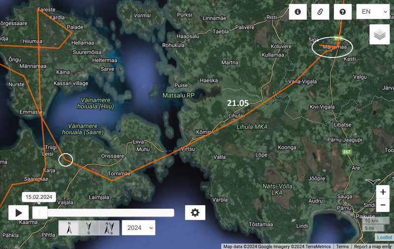
20.-21.05
Estonia: Märjamaa - a country town in Märjamaa Parish/municipality, Rapla County (western part of the country)
situation
Hello everyone
Previous data
- 19.05.2024, Distance: 7982 km (+ 178 km)
- ESTONIA: Roobaka - a village in Saaremaa Parish, Saare County (western Estonia)
NEW data
- 22.05.2024, Distance: 8255 km (+ 273 km in 3 days)
- Estonia: Koonu - a village in Väike-Maarja Parish, Lääne-Viru County (northeastern Estonia)
20.-21.05
Estonia: Märjamaa - a country town in Märjamaa Parish/municipality, Rapla County (western part of the country)
situation
-
marika.solo
- Site Admin
- Posts: 28024
- Joined: 29 Sep 2021, 09:38
Re: WABA (2022)
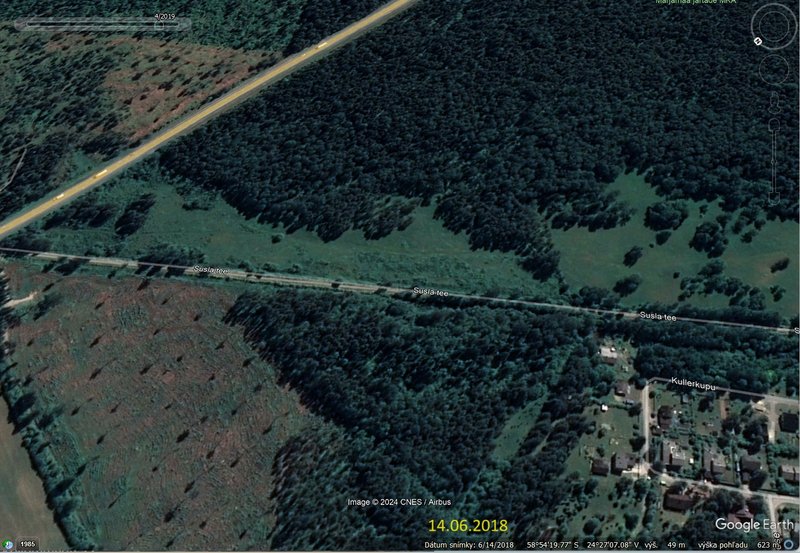
DAY 1 + Day 2 - May 20 + May 21
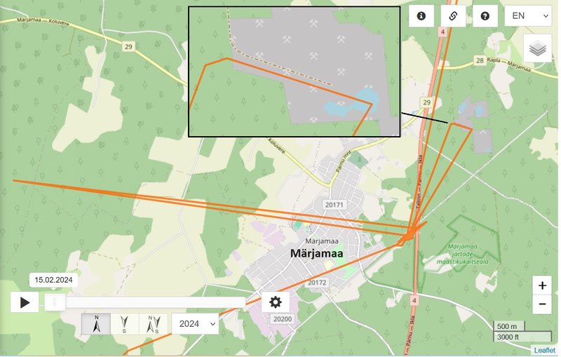
the lines are mostly in the area of the Märjamaa järtad (https://keskkonnaamet.ee/sites/default/ ... uskava.pdf)
VERY NICE PHOTOS https://marjamaa.ee/maastiku-ja-looduskaitsealad (or on flickr by Tiina Gill)
"Märjamaa järtade maastikukaitseala
Märjamaa järtade maastikukaitseala. Järvik Tammiäärsel järtal
Märjamaa järtade maastikukaitseala asub Raplamaal Märjamaa vallas Kõrtsiotsa ja Nõmmeotsa küla maadel; pindala 105,1 ha. Asutatud 1981 (pindalaga 24 ha) kahe karstilehtrite ja -lohkudega karstijärve nõo (nn järta) kaitseks. Praegused piirid, kaitse-eeskiri ja staatus 2006. aastast. Põhjavee kõrge taseme korral on järtades madalad järvikud, neil peatuvad rändlinnud. Suvel tehakse järtades heina, osaliselt on need nõod pajupõõsastesse kasvanud. Hästi vaadeldav on endise Rapla–Virtsu raudtee tammi juures asuv Tammiäärne järta." (http://entsyklopeedia.ee/artikkel/m%C3% ... ukaitseala
Märjamaa järtade landscape protection area
Märjamaa järtade landscape protection area. Lake on the Tammiäärsel järtal
The Märjamaa Landscape Protected Area is located in Märjamaa municipality, Rapla County, on the lands of Kõrtsiotsa and Nõmmeotsa villages; area 105.1 ha. Established in 1981 (area 24 ha) to protect two karstic lakes (järta) with karstic beds and boulders. Current boundaries, protection rules and status since 2006. Where groundwater levels are high, shallow lakes are found in the glaciers, where migratory birds stop. In summer, hay is made in the heaths, some of which are overgrown with willow bushes. The Tammiäärne lake, near the dam of the former Rapla-Virtsu railway line, is well visible.
more also e.g. here (english) https://infoleht.keskkonnainfo.ee/defau ... 1912462341 or http://vana.loodusajakiri.ee/eesti_lood ... _1508.html
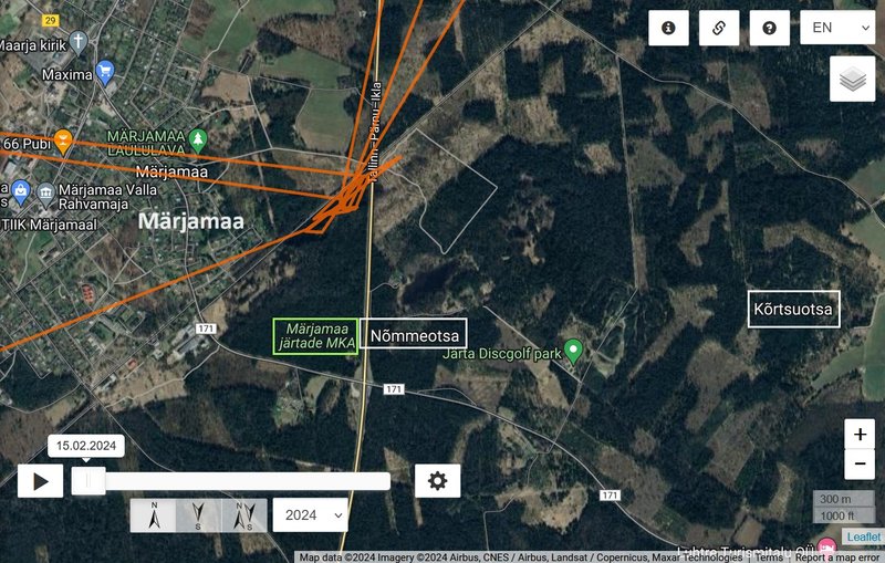
rotated view
the lines are mostly in the area of the Märjamaa järtad (https://keskkonnaamet.ee/sites/default/ ... uskava.pdf)
VERY NICE PHOTOS https://marjamaa.ee/maastiku-ja-looduskaitsealad (or on flickr by Tiina Gill)
"Märjamaa järtade maastikukaitseala
Märjamaa järtade maastikukaitseala. Järvik Tammiäärsel järtal
Märjamaa järtade maastikukaitseala asub Raplamaal Märjamaa vallas Kõrtsiotsa ja Nõmmeotsa küla maadel; pindala 105,1 ha. Asutatud 1981 (pindalaga 24 ha) kahe karstilehtrite ja -lohkudega karstijärve nõo (nn järta) kaitseks. Praegused piirid, kaitse-eeskiri ja staatus 2006. aastast. Põhjavee kõrge taseme korral on järtades madalad järvikud, neil peatuvad rändlinnud. Suvel tehakse järtades heina, osaliselt on need nõod pajupõõsastesse kasvanud. Hästi vaadeldav on endise Rapla–Virtsu raudtee tammi juures asuv Tammiäärne järta." (http://entsyklopeedia.ee/artikkel/m%C3% ... ukaitseala
Märjamaa järtade landscape protection area
Märjamaa järtade landscape protection area. Lake on the Tammiäärsel järtal
The Märjamaa Landscape Protected Area is located in Märjamaa municipality, Rapla County, on the lands of Kõrtsiotsa and Nõmmeotsa villages; area 105.1 ha. Established in 1981 (area 24 ha) to protect two karstic lakes (järta) with karstic beds and boulders. Current boundaries, protection rules and status since 2006. Where groundwater levels are high, shallow lakes are found in the glaciers, where migratory birds stop. In summer, hay is made in the heaths, some of which are overgrown with willow bushes. The Tammiäärne lake, near the dam of the former Rapla-Virtsu railway line, is well visible.
more also e.g. here (english) https://infoleht.keskkonnainfo.ee/defau ... 1912462341 or http://vana.loodusajakiri.ee/eesti_lood ... _1508.html
rotated view